File:Map of Tibet in 1782, Hindoostan (20118721954) (cropped).jpg
Size of this preview: 800 × 327 pixels. Other resolutions: 320 × 131 pixels | 1,114 × 455 pixels.
Original file (1,114 × 455 pixels, file size: 593 KB, MIME type: image/jpeg)
Captions
Captions
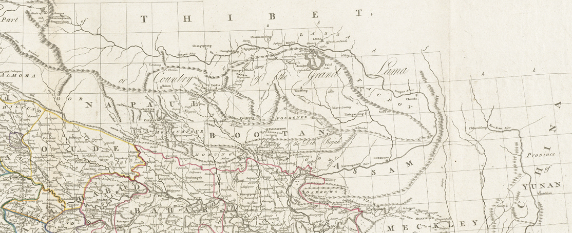
Map of Tibet in 1782
Summary edit
| Description |
Zoom into this map at maps.bpl.org. Author: Rennell, James Publisher: Rennell, James Date: 1782 Location: South Asia Dimensions: 78 x 79 cm Scale: Scale approximately 1:4,450,000 Call Number: G1015 .A85 1783 |
| Date | |
| Source | Hindoostan |
| Author | Norman B. Leventhal Map Center |
| Other versions |
.jpg)
_(cropped).jpg&action=edit§ion=1)
Licensing edit
_(cropped).jpg&action=edit§ion=2)
This file is licensed under the Creative Commons Attribution 2.0 Generic license.
- You are free:
- to share – to copy, distribute and transmit the work
- to remix – to adapt the work
- Under the following conditions:
- attribution – You must give appropriate credit, provide a link to the license, and indicate if changes were made. You may do so in any reasonable manner, but not in any way that suggests the licensor endorses you or your use.
| Annotations | This image is annotated: View the annotations at Commons |
_(cropped).jpg)
File history
Click on a date/time to view the file as it appeared at that time.
| Date/Time | Thumbnail | Dimensions | User | Comment | |
|---|---|---|---|---|---|
| current | 13:42, 10 May 2019 | 1,114 × 455 (593 KB) | Tibet Nation (talk | contribs) | File:Hindoostan (20118721954).jpg cropped 44 % horizontally, 77 % vertically using CropTool with precise mode. |
You cannot overwrite this file.
File usage on Commons
The following 4 pages use this file:
_(cropped).jpg&oldid=685724626)