File:Map of USA.png
Size of this preview: 800 × 525 pixels. Other resolutions: 320 × 210 pixels | 640 × 420 pixels | 904 × 593 pixels.
Original file (904 × 593 pixels, file size: 24 KB, MIME type: image/png)
Captions
Captions
Add a one-line explanation of what this file represents
Summary edit
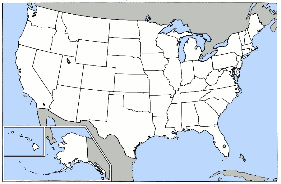
United States blank state outline map. This is the blank version of the map used for U.S. states and national park locations, etc., in Wikipedia. [1]
![[1]](https://en.wikipedia.org/wiki/Image:Map_of_USA.png)
Licensing edit

|
Permission is granted to copy, distribute and/or modify this document under the terms of the GNU Free Documentation License, Version 1.2 or any later version published by the Free Software Foundation; with no Invariant Sections, no Front-Cover Texts, and no Back-Cover Texts. A copy of the license is included in the section entitled GNU Free Documentation License. |
| This file is licensed under the Creative Commons Attribution-Share Alike 3.0 Unported license. | ||
| ||
| This licensing tag was added to this file as part of the GFDL licensing update. |

|
File:StatesU.svg is a vector version of this file. It should be used in place of this PNG file when not inferior.
File:Map of USA.png → File:StatesU.svg
For more information, see Help:SVG. |
 |
File history
Click on a date/time to view the file as it appeared at that time.
| Date/Time | Thumbnail | Dimensions | User | Comment | |
|---|---|---|---|---|---|
| current | 17:41, 14 March 2012 | | 904 × 593 (24 KB) | Smileguy91 (talk | contribs) | Reverted to version as of 03:32, 12 May 2006 |
| 16:07, 5 March 2008 |  | 904 × 593 (24 KB) | Briangotts (talk | contribs) | Reverted to version as of 00:22, 16 February 2008 | |
| 16:07, 5 March 2008 |  | 904 × 593 (52 KB) | Briangotts (talk | contribs) | {{Information |Description=Map of the w:United States, showing areas covered by each of the state compilation w:law reports published by w:Thomson West. :*Purple: w:North Eastern Reporter :*Orange: w:Atlantic Reporter :*Yellow: [[w:Nor | |
| 00:22, 16 February 2008 |  | 904 × 593 (24 KB) | Brianski (talk | contribs) | Clean up some artifacts, especially around black lines, and gray in the ocean. | |
| 03:32, 12 May 2006 |  | 904 × 593 (24 KB) | Roke~commonswiki (talk | contribs) | United States blank state outline map. This is the blank version of the map used for U.S. states and national park locations, etc., in Wikipedia. [http://en.wikipedia.org/wiki/Image:Map_of_USA.png] Category: Blank maps of the United States |
You cannot overwrite this file.
File usage on Commons
The following 2 pages use this file:
File usage on other wikis
The following other wikis use this file:
- Usage on bpy.wikipedia.org
- মডেল:তিলপারাষ্ট্র-লইনাসে
- কুইন্স কাউন্টি, নিউ ইয়র্ক
- আউটোগা কাউন্টি, আলাবামা
- চেরোকি কাউন্টি, আলাবামা
- গ্রীনলী কাউন্টি, অ্যারিজোনা
- লা পাজ কাউন্টি, অ্যারিজোনা
- মারিকোপা কাউন্টি, অ্যারিজোনা
- মোহাবে কাউন্টি, অ্যারিজোনা
- নাবাজো কাউন্টি, অ্যারিজোনা
- প্রিমা কাউন্টি, অ্যারিজোনা
- পিনাল কাউন্টি, অ্যারিজোনা
- সান্তা ক্রোজ কাউন্টি, অ্যারিজোনা
- ইয়াবাপাই কাউন্টি, অ্যারিজোনা
- য়ুমা কাউন্টি, অ্যারিজোনা
- চিলটন কাউন্টি, আলাবামা
- আরকান্সাস কাউন্টি, আরকান্সাস
- এশলি কাউন্টি, আরকান্সাস
- বক্সটের কাউন্টি, আরকান্সাস
- বেনটন কাউন্টি, আরকান্সাস
- বোনে কাউন্টি, আরকান্সাস
- ব্রাডলি কাউন্টি, আরকান্সাস
- কালহৌন কাউন্টি, আরকান্সাস
- কেরোল কাউন্টি, আরকান্সাস
- চিকোট কাউন্টি, আরকান্সাস
- ক্লার্ক কাউন্টি, আরকান্সাস
- চোকটাউ কাউন্টি, আলাবামা
- ক্লে কাউন্টি, আরকান্সাস
- ক্লেবোর্ন কাউন্টি, আরকান্সাস
- ক্লিবল্যন্ড কাউন্টি, আরকান্সাস
- কলম্বিয়া কাউন্টি, আরকান্সাস
- কনৱে কাউন্টি, আরকান্সাস
- ক্রেইগহেড কাউন্টি, আরকান্সাস
- ক্রফোর্ড কাউন্টি, আরকান্সাস
- ক্রিটেনডেন কাউন্টি, আরকান্সাস
- ক্রশ কাউন্টি, আরকান্সাস
- ডাল্লাস কাউন্টি, আরকান্সাস
- ক্লার্কে কাউন্টি, আলাবামা
- ডেসা কাউন্টি, আরকান্সাস
- ড্রিউ কাউন্টি, আরকান্সাস
- ফ্লাকনার কাউন্টি, আরকান্সাস
- ফ্রাঙ্কলিন কাউন্টি, আরকান্সাস
- ফুলটন কাউন্টি, আরকান্সাস
- গারল্যন্ড কাউন্টি, আরকান্সাস
- গ্রান্ট কাউন্টি, আরকান্সাস
- গ্রীন কাউন্টি, আরকান্সাস
- হেমস্টেড কাউন্টি, আরকান্সাস
- হট স্প্রিং কাউন্টি, আরকান্সাস
- ক্লে কাউন্টি, আলাবামা
- হাৱার্ড কাউন্টি, আরকান্সাস
- ইন্ডিপেনডেন্স কাউন্টি, আরকান্সাস
View more global usage of this file.