File:Map of Ukraine political simple Oblast Donezk.png

Size of this preview: 800 × 533 pixels. Other resolutions: 320 × 213 pixels | 640 × 426 pixels | 1,024 × 682 pixels | 1,200 × 799 pixels.
Original file (1,200 × 799 pixels, file size: 140 KB, MIME type: image/png)
Captions
Captions
Add a one-line explanation of what this file represents
Summary
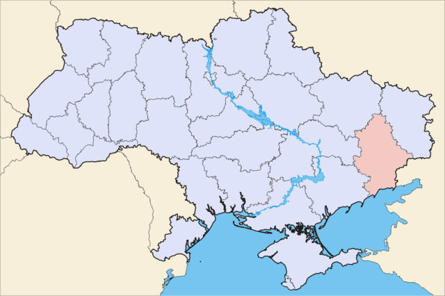
edit| Description | Political map of Ukraine, highlighting Donetsk Oblast | ||||||
| Date | |||||||
| Source | Image (Map) made by Sven Teschke, Germany --Steschke 18:49, 6 Nov 2004 (UTC) | ||||||
| Author | Sven Teschke | ||||||
| Other versions |
[]
|


Licensing
edit

|
Permission is granted to copy, distribute and/or modify this document under the terms of the GNU Free Documentation License, Version 1.2 or any later version published by the Free Software Foundation; with no Invariant Sections, no Front-Cover Texts, and no Back-Cover Texts. A copy of the license is included in the section entitled GNU Free Documentation License. |
| This file is licensed under the Creative Commons Attribution-Share Alike 3.0 Unported license. | ||
| ||
| This licensing tag was added to this file as part of the GFDL licensing update. |
This file is licensed under the Creative Commons Attribution-Share Alike 1.0 Generic license.
- You are free:
- to share – to copy, distribute and transmit the work
- to remix – to adapt the work
- Under the following conditions:
- attribution – You must give appropriate credit, provide a link to the license, and indicate if changes were made. You may do so in any reasonable manner, but not in any way that suggests the licensor endorses you or your use.
- share alike – If you alter, transform, or build upon this work, you must distribute the resulting work under the same license as the original.
File history
Click on a date/time to view the file as it appeared at that time.
| Date/Time | Thumbnail | Dimensions | User | Comment | |
|---|---|---|---|---|---|
| current | 13:45, 13 May 2014 | | 1,200 × 799 (140 KB) | Aotearoa (talk | contribs) | Reverted to version as of 21:45, 4 May 2014 - if you need map without Crimea then upload it as another file |
| 09:13, 11 May 2014 |  | 1,200 × 799 (67 KB) | DeJaDenis (talk | contribs) | Reverted to version as of 23:27, 3 May 2014 | |
| 21:45, 4 May 2014 |  | 1,200 × 799 (140 KB) | Musp (talk | contribs) | Reverted to version as of 09:12, 16 August 2012 | |
| 00:55, 4 May 2014 |  | 1,971 × 1,309 (365 KB) | Knyaz-1988 (talk | contribs) | New version | |
| 23:27, 3 May 2014 |  | 1,200 × 799 (67 KB) | Knyaz-1988 (talk | contribs) | New version | |
| 09:12, 16 August 2012 |  | 1,200 × 799 (140 KB) | Whiteroll (talk | contribs) | Correct map uploaded: Krasnyi Lyman Raion returned to Donetsk Oblast, it has never been a part of Kharkiv Oblast | |
| 00:32, 6 May 2012 |  | 2,466 × 1,749 (283 KB) | An678ko (talk | contribs) | redesigned by Aplusc Studio | |
| 14:42, 30 November 2004 |  | 1,181 × 825 (16 KB) | Ed g2s (talk | contribs) | Simplified, compressed. | |
| 18:47, 6 November 2004 |  | 709 × 495 (195 KB) | Steschke (talk | contribs) | ukrainian oblast |
You cannot overwrite this file.
File usage on Commons
The following 33 pages use this file:
- Maps of Ukraine
- File:Map of Ukraine political simple City Sewastopol.png
- File:Map of Ukraine political simple Donbass.png
- File:Map of Ukraine political simple Oblast Charkiw.png
- File:Map of Ukraine political simple Oblast Cherson.png
- File:Map of Ukraine political simple Oblast Chmelnyzkyj.png
- File:Map of Ukraine political simple Oblast Czernowitz.png
- File:Map of Ukraine political simple Oblast Dnipropetrowsk.png
- File:Map of Ukraine political simple Oblast Donezk.png
- File:Map of Ukraine political simple Oblast Iwano-Frankiwsk.png
- File:Map of Ukraine political simple Oblast Kiew.png
- File:Map of Ukraine political simple Oblast Kirowohrad.png
- File:Map of Ukraine political simple Oblast Krim.png
- File:Map of Ukraine political simple Oblast Lemberg.png
- File:Map of Ukraine political simple Oblast Luhansk.png
- File:Map of Ukraine political simple Oblast Mykolajiw.png
- File:Map of Ukraine political simple Oblast Odessa.png
- File:Map of Ukraine political simple Oblast Poltawa.png
- File:Map of Ukraine political simple Oblast Rivne.png
- File:Map of Ukraine political simple Oblast Saporischja.png
- File:Map of Ukraine political simple Oblast Schytomyr.png
- File:Map of Ukraine political simple Oblast Sumy.png
- File:Map of Ukraine political simple Oblast Ternopil.png
- File:Map of Ukraine political simple Oblast Transkarpatien.png
- File:Map of Ukraine political simple Oblast Tscherkasy.png
- File:Map of Ukraine political simple Oblast Tschernihiw.png
- File:Map of Ukraine political simple Oblast Wolhynien.png
- File:Map of Ukraine political simple Oblast Wynnyzja.png
- File:Map of Ukraine political simple blank.png
- File:Map of Ukraine political simple city Kiew.png
- File:Map of Ukrainian Premier League 2008-09-Ukrainian.png
- File:Svitlovodsk-Ukraine-Map.png
- Template:Other versions/Map of Ukraine political simple
File usage on other wikis
The following other wikis use this file:
- Usage on avk.wikipedia.org
- Usage on be.wikipedia.org
- Usage on cs.wikipedia.org
- Usage on de.wikipedia.org
- Flaggen und Wappen der ukrainischen Oblaste
- Rajon Nowoasowsk
- Rajon Telmanowe
- Rajon Starobeschewe
- Rajon Wolnowacha
- Rajon Amwrossijiwka
- Rajon Schachtarsk
- Rajon Nikolske
- Rajon Manhusch
- Rajon Bachmut
- Rajon Lyman (Donezk)
- Rajon Pokrowsk
- Rajon Marjinka
- Rajon Welyka Nowosilka
- Rajon Dobropillja
- Rajon Oleksandriwka (Donezk)
- Rajon Slowjansk
- Rajon Kostjantyniwka
- Rajon Jassynuwata
- Rajon Mariupol
- Rajon Kramatorsk
- Rajon Horliwka
- Rajon Donezk
- Rajon Kalmiuske
- Usage on eo.wikipedia.org
- Usage on es.wikipedia.org
- Raión de Amvrosivka
- Raión de Velyka Novosilka
- Raión de Volnovaja
- Raión de Nikolske
- Raión de Dobropilia
- Raión de Kostantínovka
- Raión de Pokrovsk
- Raión de Limán (óblast de Donetsk)
- Raión de Márinka
- Raión de Novoazovsk
- Raión de Oleksandrivka (Donetsk)
- Raión de Mánjush
- Raión de Sloviansk
- Raión de Starobesheve
- Raión de Boikivske
- Raión de Shajtarsk
- Raión de Yasinuvata
- Usage on eu.wikipedia.org
- Usage on fi.wikipedia.org
- Usage on hr.wikipedia.org
- Usage on hu.wikipedia.org
- Usage on hy.wikipedia.org
View more global usage of this file.