File:Map of Viborg.png
Size of this preview: 800 × 455 pixels. Other resolutions: 320 × 182 pixels | 640 × 364 pixels | 1,024 × 583 pixels | 1,280 × 728 pixels | 2,225 × 1,266 pixels.
Original file (2,225 × 1,266 pixels, file size: 2.52 MB, MIME type: image/png)
Captions
Captions
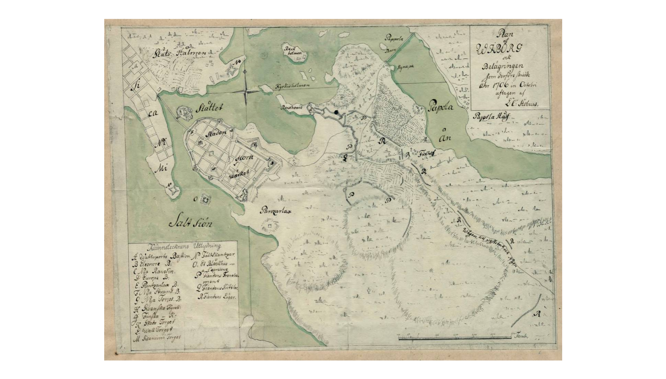
Map over Viborg in 1706
Summary
edit
| Description |
Svenska: "Plan af Wiborg och Belägringen som derföre skiedde Åhr 1706 in Octobri.". Viborg stad samt ryska lägret med befästningar. |
| Date | |
| Source | https://sok.riksarkivet.se/bildvisning/K0024768_00001#?c=&m=&s=&cv=&xywh=-1214%2C-221%2C7754%2C4413 |
| Author | Unknown |
Licensing
edit
| This file is made available under the Creative Commons CC0 1.0 Universal Public Domain Dedication. | |
| The person who associated a work with this deed has dedicated the work to the public domain by waiving all of their rights to the work worldwide under copyright law, including all related and neighboring rights, to the extent allowed by law. You can copy, modify, distribute and perform the work, even for commercial purposes, all without asking permission.
|
File history
Click on a date/time to view the file as it appeared at that time.
| Date/Time | Thumbnail | Dimensions | User | Comment | |
|---|---|---|---|---|---|
| current | 09:27, 18 November 2023 | | 2,225 × 1,266 (2.52 MB) | Gvssy (talk | contribs) | Uploaded a work by Unknown from https://sok.riksarkivet.se/bildvisning/K0024768_00001#?c=&m=&s=&cv=&xywh=-1214%2C-221%2C7754%2C4413 with UploadWizard |
You cannot overwrite this file.
File usage on Commons
There are no pages that use this file.