File:Map of Virginia highlighting Spotsylvania County.svg

Size of this PNG preview of this SVG file: 800 × 347 pixels. Other resolutions: 320 × 139 pixels | 640 × 278 pixels | 1,024 × 444 pixels | 1,280 × 555 pixels | 2,560 × 1,110 pixels | 7,486 × 3,247 pixels.
Original file (SVG file, nominally 7,486 × 3,247 pixels, file size: 223 KB)
Captions
Captions
Add a one-line explanation of what this file represents
Summary edit
| Description |
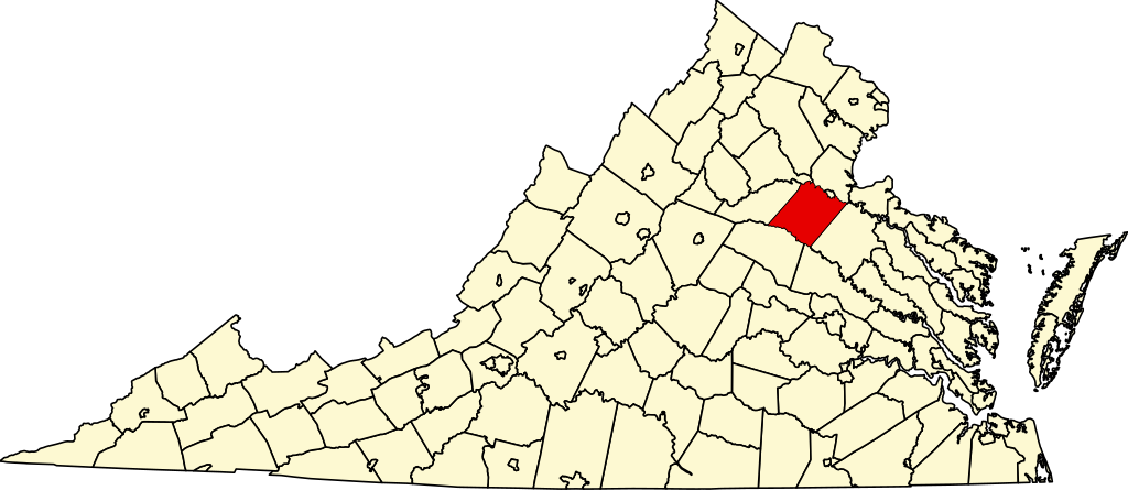
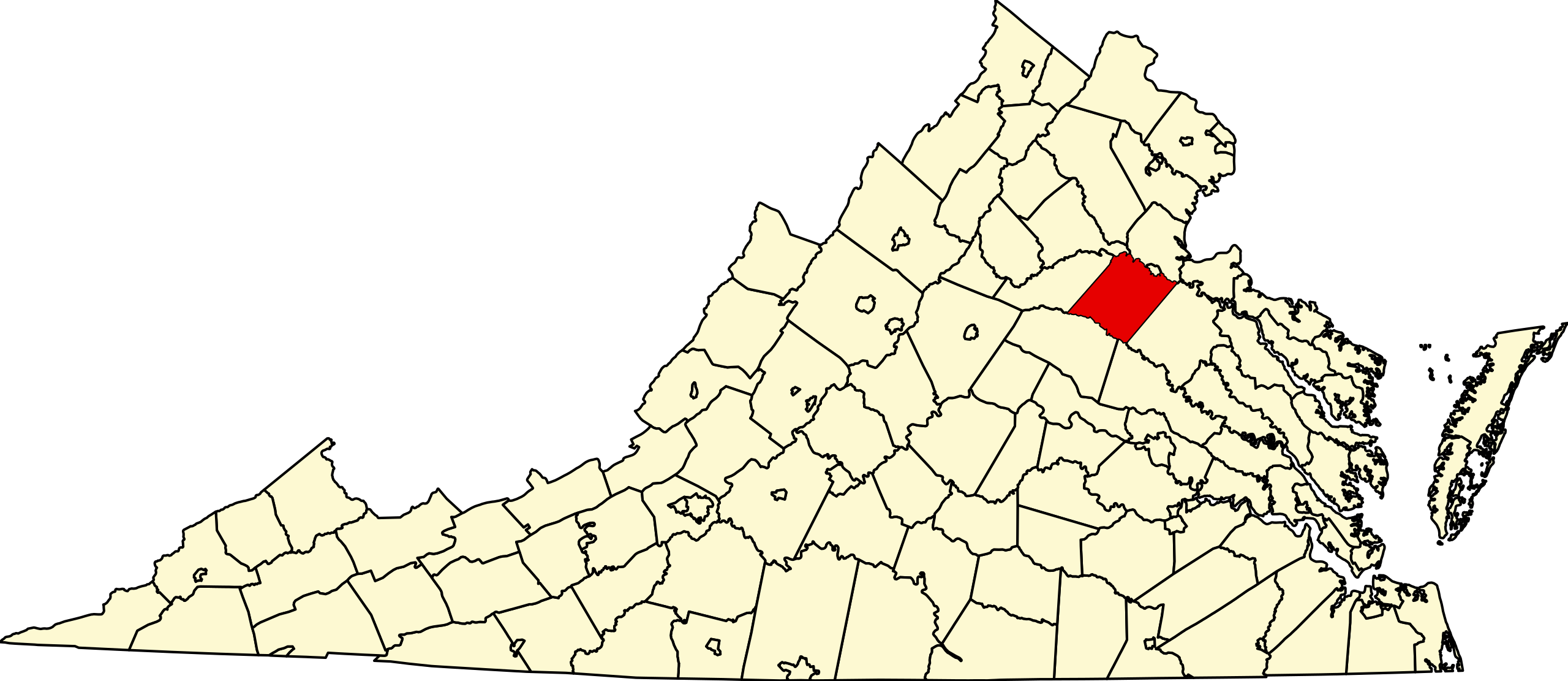
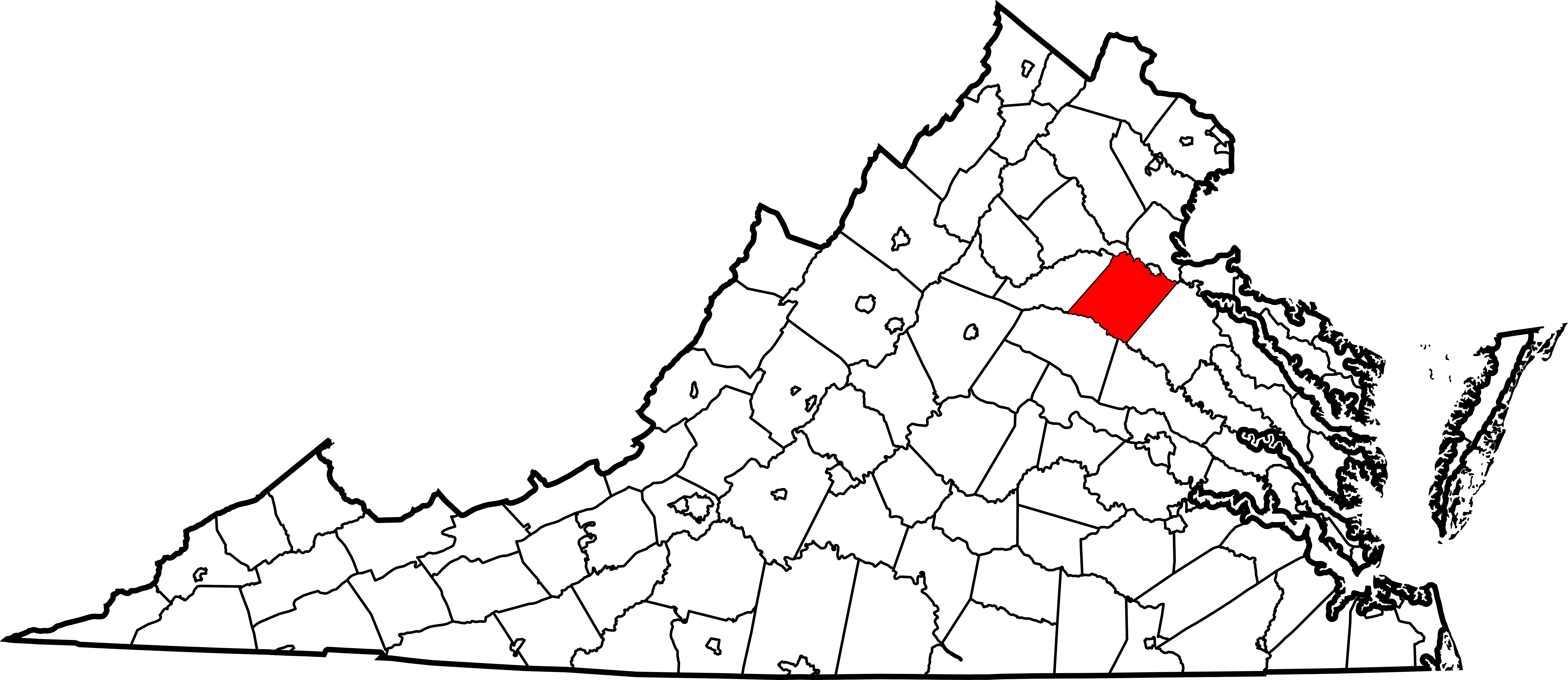
English: This is a locator map showing Spotsylvania County in Virginia. For more information, see Commons:United States county locator maps. |
| Date | |
| Source |
Own work: English: The maps use data from nationalatlas.gov, specifically countyp020.tar.gz on the Raw Data Download page. The maps also use state outline data from statesp020.tar.gz. The Florida maps use hydrogm020.tar.gz to display Lake Okeechobee. |
| Author | David Benbennick |
| SVG development |
Licensing edit
| I, the copyright holder of this work, release this work into the public domain. This applies worldwide. In some countries this may not be legally possible; if so: I grant anyone the right to use this work for any purpose, without any conditions, unless such conditions are required by law. |
File history
Click on a date/time to view the file as it appeared at that time.
| Date/Time | Thumbnail | Dimensions | User | Comment | |
|---|---|---|---|---|---|
| current | 17:59, 12 February 2006 | | 7,486 × 3,247 (223 KB) | David Benbennick (talk | contribs) | {{subst:User:Dbenbenn/clm|county=Spotsylvania County|state=Virginia|type=county}} |
You cannot overwrite this file.
File usage on Commons
The following 7 pages use this file:
- Category:Births in Spotsylvania County, Virginia
- Category:Deaths in Spotsylvania County, Virginia
- Category:Maps of Spotsylvania County, Virginia
- Category:National Register of Historic Places in Spotsylvania County, Virginia
- Category:People of Spotsylvania County, Virginia
- Category:Populated places in Spotsylvania County, Virginia
- Category:Spotsylvania County, Virginia
File usage on other wikis
The following other wikis use this file:
- Usage on ar.wikipedia.org
- Usage on bpy.wikipedia.org
- Usage on cdo.wikipedia.org
- Usage on ceb.wikipedia.org
- Usage on ce.wikipedia.org
- Usage on cy.wikipedia.org
- Usage on de.wikipedia.org
- Usage on en.wikipedia.org
- Battle of Fredericksburg
- List of cities and counties in Virginia
- Spotsylvania County, Virginia
- Spotsylvania Courthouse, Virginia
- Chancellorsville, Virginia
- Category:Spotsylvania County, Virginia
- Cosner's Corner
- Thornburg, Virginia
- Leavells, Virginia
- Template:Spotsylvania County, Virginia
- Alsop, Virginia
- Arcadia, Spotsylvania County, Virginia
- Four Mile Fork, Virginia
- Massaponax, Virginia
- Lake Anna State Park
- Partlow, Virginia
- Post Oak, Virginia
- Brockroad, Virginia
- Stubbs, Virginia
- Todds Tavern, Virginia
- National Register of Historic Places listings in Spotsylvania County, Virginia
- Template:SpotsylvaniaCountyVA-geo-stub
- User:Nyttend/County templates/VA/2
- User:LBourne/Scratch pad
- Wilderness, Virginia
- Artillery Ridge, Virginia
- Bells Crossroad, Virginia
- Belmont, Spotsylvania County, Virginia
- Blades Corner, Virginia
- Brokenburg, Virginia
- Chancellor, Virginia
- Cookstown, Virginia
- Dunavant, Virginia
- Five Mile Fork, Virginia
- Granite Springs, Virginia
- Lewiston, Virginia
- Margo, Virginia
- Marye, Virginia
- McHenry, Virginia
View more global usage of this file.