File:Map of Wisconsin highlighting Lafayette County.svg

Size of this PNG preview of this SVG file: 559 × 599 pixels. Other resolutions: 224 × 240 pixels | 448 × 480 pixels | 717 × 768 pixels | 956 × 1,024 pixels | 1,911 × 2,048 pixels | 4,747 × 5,087 pixels.
Original file (SVG file, nominally 4,747 × 5,087 pixels, file size: 103 KB)
Captions
Captions
Add a one-line explanation of what this file represents
Summary
edit
| Description |
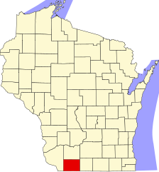
English: This is a locator map showing Lafayette County in Wisconsin. For more information, see Commons:United States county locator maps. |
| Date | |
| Source |
Own work: English: The maps use data from nationalatlas.gov, specifically countyp020.tar.gz on the Raw Data Download page. The maps also use state outline data from statesp020.tar.gz. The Florida maps use hydrogm020.tar.gz to display Lake Okeechobee. |
| Author | David Benbennick |
Licensing
edit
| I, the copyright holder of this work, release this work into the public domain. This applies worldwide. In some countries this may not be legally possible; if so: I grant anyone the right to use this work for any purpose, without any conditions, unless such conditions are required by law. |
File history
Click on a date/time to view the file as it appeared at that time.
| Date/Time | Thumbnail | Dimensions | User | Comment | |
|---|---|---|---|---|---|
| current | 00:23, 13 February 2006 | | 4,747 × 5,087 (103 KB) | David Benbennick (talk | contribs) | {{subst:User:Dbenbenn/clm|county=Lafayette County|state=Wisconsin|type=county}} |
| 18:16, 12 February 2006 |  | 4,747 × 5,087 (103 KB) | David Benbennick (talk | contribs) | {{subst:User:Dbenbenn/clm|county=Lafayette County|state=Wisconsin|type=county}} |
You cannot overwrite this file.
File usage on Commons
The following 8 pages use this file:
- Category:Births in Lafayette County, Wisconsin
- Category:Geography of Lafayette County, Wisconsin
- Category:Lafayette County, Wisconsin
- Category:Maps of Lafayette County, Wisconsin
- Category:People of Lafayette County, Wisconsin
- Category:Populated places in Lafayette County, Wisconsin
- Category:Transport in Lafayette County, Wisconsin
- Category:Villages in Lafayette County, Wisconsin
File usage on other wikis
The following other wikis use this file:
- Usage on ar.wikipedia.org
- بلانشارد (ويسكونسن)
- دارلينغتون (ويسكونسن)
- إلك غروف (ويسكونسن)
- فايت (ويسكونسن)
- لامونت (ويسكونسن)
- مونتايسلو (مقاطعة لافاييت)
- نيو ديغينغز (ويسكونسن)
- سيمور (مقاطعة لافاييت)
- شولسورغ (ويسكونسن)
- واين مقاطعة لافاييت (ويسكونسن)
- وايت أواك سبرينغز (ويسكونسن)
- ويلو سبرينغز (ويسكونسن)
- ويوتا (ويسكونسن)
- مقاطعة لافاييت (ويسكونسن)
- دارلينجتون
- شولسبورغ
- كوبا سيتي
- أرجيلي (ويسكونسن)
- بيلمونت (ويسكونسن)
- بنتون (ويسكونسن)
- غراتيوت (ويسكونسن)
- هازل غرين (ويسكونسن)
- بلانتشاردفيل (ويسكونسن)
- ساوث واين (ويسكونسن)
- قالب:مقاطعة لافاييت (ويسكونسن)
- Usage on bg.wikipedia.org
- Usage on bpy.wikipedia.org
- Usage on cdo.wikipedia.org
- Usage on ceb.wikipedia.org
- Usage on ce.wikipedia.org
- Usage on cy.wikipedia.org
- Usage on de.wikipedia.org
- Usage on en.wikipedia.org
- List of counties in Wisconsin
- Lafayette County, Wisconsin
- Blanchard, Wisconsin
- Elk Grove, Wisconsin
- Fayette, Wisconsin
- Kendall, Lafayette County, Wisconsin
- Lamont, Wisconsin
- Monticello, Lafayette County, Wisconsin
- New Diggings, Wisconsin
- Seymour, Lafayette County, Wisconsin
- South Wayne, Wisconsin
- Wayne, Lafayette County, Wisconsin
- White Oak Springs, Wisconsin
- Willow Springs, Wisconsin
View more global usage of this file.