File:Map of closed area around Blue Mesa due to investigation (17b86712-996c-41c0-bf70-bcbdfffbab1e).jpg

Size of this preview: 463 × 599 pixels. Other resolutions: 185 × 240 pixels | 371 × 480 pixels | 593 × 768 pixels | 791 × 1,024 pixels | 2,550 × 3,300 pixels.
Original file (2,550 × 3,300 pixels, file size: 2.45 MB, MIME type: image/jpeg)
Captions
Captions
Add a one-line explanation of what this file represents

|
The categories of this image need checking. You can do so here.
|
.jpg&action=edit&withJS=MediaWiki:Catcheck.js)
Summary
edit.jpg&action=edit§ion=1)
| English: Map Q.jpg | ||||
|---|---|---|---|---|
| Photographer |
English: NPS |
|||
| Title |
English: Map Q.jpg |
|||
| Description |
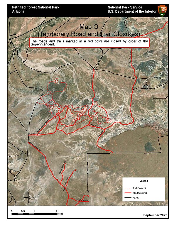
English: Satellite map with black and red roads Map of closed area around Blue Mesa due to investigation |
|||
| Depicted place |
English: Petrified Forest National Park, Arizona |
|||
| Date | Taken on 21 September 2022 | |||
| Accession number | ||||
| Source |
English: NPGallery |
|||
| Permission (Reusing this file) |
|
|||
| NPS Unit Code | PEFO | |||
File history
Click on a date/time to view the file as it appeared at that time.
| Date/Time | Thumbnail | Dimensions | User | Comment | |
|---|---|---|---|---|---|
| current | 00:09, 22 June 2023 | | 2,550 × 3,300 (2.45 MB) | BMacZeroBot (talk | contribs) | Batch upload (Commons:Batch uploading/NPGallery) |
You cannot overwrite this file.
File usage on Commons
The following page uses this file:
.jpg)
.jpg&oldid=799036648)