File:Map of marstall in dresden 1804.jpg
No higher resolution available.
Map_of_marstall_in_dresden_1804.jpg (505 × 531 pixels, file size: 112 KB, MIME type: image/jpeg)
Captions
Captions
Add a one-line explanation of what this file represents
Summary
edit
| Description |
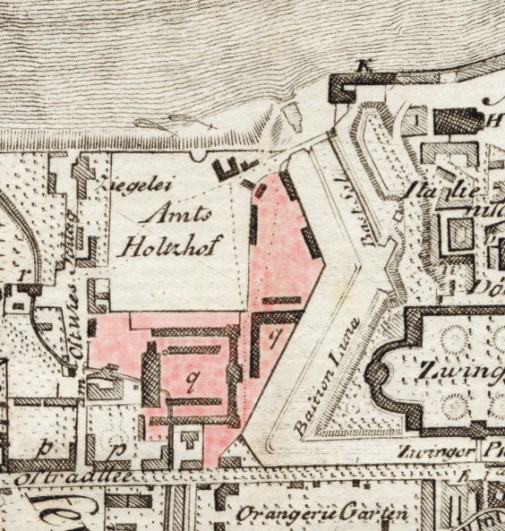
Deutsch: Stadtplan von Dresden (Teil der Wilsdruffer Vorstadt) von J. Georg Lehmann, gezeichnet 1801, verbessert 1804, gedruckt 1809 der Marstall (Signatur q Könlg. Ställe u. Reitbahn) |
| Date | |
| Source | old city map (copper-plate engraving) |
| Author | J. Georg Lehmann |
Licensing
edit
|
This work is in the public domain in its country of origin and other countries and areas where the copyright term is the author's life plus 100 years or fewer. | |
| This file has been identified as being free of known restrictions under copyright law, including all related and neighboring rights. | |
File history
Click on a date/time to view the file as it appeared at that time.
| Date/Time | Thumbnail | Dimensions | User | Comment | |
|---|---|---|---|---|---|
| current | 18:58, 1 November 2009 | | 505 × 531 (112 KB) | Lysippos (talk | contribs) | {{Information |Description={{de|1=Stadtplan von Dresden (Teil der Wilsdruffer Vorstadt) von J. Georg Lehmann, gezeichnet 1801, verbessert 1804, gedruckt 1809<br /> der Marstall (Signatur '''q''' ''Könlg. Ställe u. Reitbahn'')<br /> (Gelände des Marstal |
You cannot overwrite this file.
File usage on Commons
The following page uses this file:
File usage on other wikis
The following other wikis use this file:
- Usage on de.wikibooks.org