File:Map of the 2021 Caymanian general election.svg

Size of this PNG preview of this SVG file: 732 × 600 pixels. Other resolutions: 293 × 240 pixels | 586 × 480 pixels | 937 × 768 pixels | 1,250 × 1,024 pixels | 2,499 × 2,048 pixels | 1,534 × 1,257 pixels.
Original file (SVG file, nominally 1,534 × 1,257 pixels, file size: 177 KB)
Captions
Captions
Add a one-line explanation of what this file represents
Summary
edit
| Description |
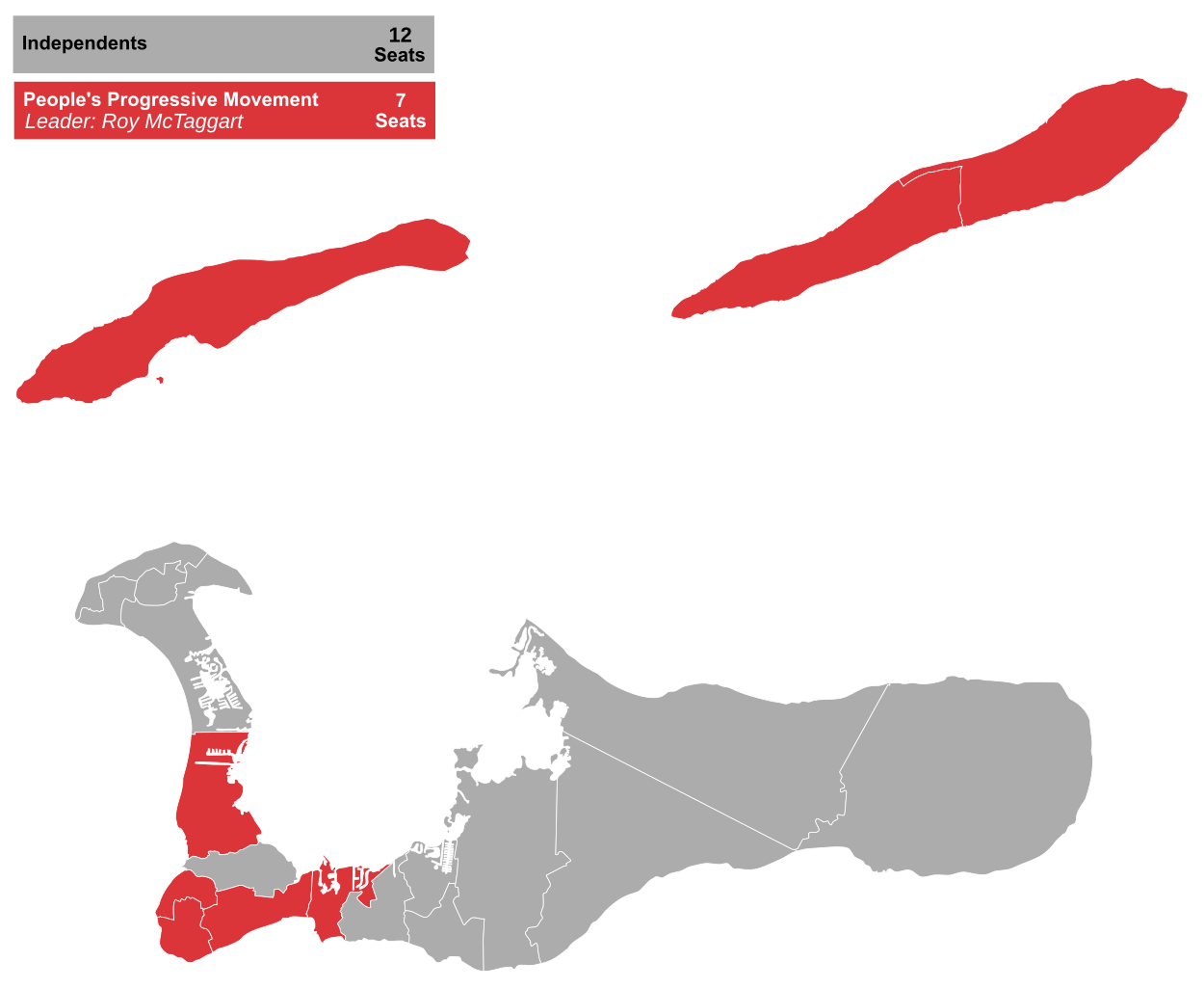
English: Results of the 2021 Caymanian general election in 19 constituencies for the Legislative Assembly. |
| Date | |
| Source | Own work using File:Map of the 2017 Caymanian general election.svg |
| Author | RaviC, JDuggan (original) |
Licensing
edit
I, the copyright holder of this work, hereby publish it under the following license:
This file is licensed under the Creative Commons Attribution-Share Alike 4.0 International license.
- You are free:
- to share – to copy, distribute and transmit the work
- to remix – to adapt the work
- Under the following conditions:
- attribution – You must give appropriate credit, provide a link to the license, and indicate if changes were made. You may do so in any reasonable manner, but not in any way that suggests the licensor endorses you or your use.
- share alike – If you remix, transform, or build upon the material, you must distribute your contributions under the same or compatible license as the original.
File history
Click on a date/time to view the file as it appeared at that time.
| Date/Time | Thumbnail | Dimensions | User | Comment | |
|---|---|---|---|---|---|
| current | 10:28, 30 April 2021 | | 1,534 × 1,257 (177 KB) | RaviC (talk | contribs) | layout |
| 10:26, 30 April 2021 |  | 1,534 × 1,257 (177 KB) | RaviC (talk | contribs) | =={{int:filedesc}}== {{Information |description={{en|1=Results of the 2021 Caymanian general election in 19 constituencies for the Legislative Assembly.}} |date=30.04.2021 |source={{own}} using File:Map of the 2017 Caymanian general election.svg |author=RaviC, JDuggan (original) |permission= |other versions= }} =={{int:license-header}}== {{self|cc-by-sa-4.0}} Category:Election maps of British Overseas Territories |
You cannot overwrite this file.
File usage on Commons
The following page uses this file:
File usage on other wikis
The following other wikis use this file:
- Usage on en.wikipedia.org
- Usage on es.wikipedia.org
- Usage on fr.wikipedia.org