File:Map of the City of New York, Political Divisions and Subdivisions, 1870.jpg

Size of this preview: 800 × 307 pixels. Other resolutions: 320 × 123 pixels | 640 × 245 pixels | 1,024 × 393 pixels | 1,280 × 491 pixels | 2,560 × 981 pixels | 8,381 × 3,213 pixels.
Original file (8,381 × 3,213 pixels, file size: 4.9 MB, MIME type: image/jpeg)
Captions
Captions
Add a one-line explanation of what this file represents
Summary edit
| Description |
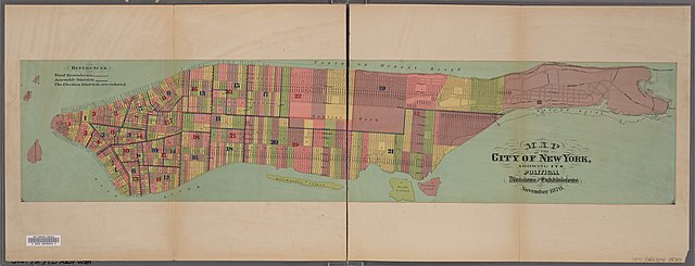
English: Title: Map of the City of New York showing its political Divisions and Subdivisions, November 1870
|
||
| Date | |||
| Source |
|
||
| Author | Valentine's Manual for 1870 |
Licensing edit
|
This work is in the public domain in its country of origin and other countries and areas where the copyright term is the author's life plus 70 years or fewer. This work is in the public domain in the United States because it was published (or registered with the U.S. Copyright Office) before January 1, 1929. | |
| This file has been identified as being free of known restrictions under copyright law, including all related and neighboring rights. | |
File history
Click on a date/time to view the file as it appeared at that time.
| Date/Time | Thumbnail | Dimensions | User | Comment | |
|---|---|---|---|---|---|
| current | 08:50, 14 January 2021 | 8,381 × 3,213 (4.9 MB) | Vzeebjtf (talk | contribs) | Uploaded a work by ''Valentine's Manual'' for 1870 from {{NYPL-Image-ImageID|ID=5056973}} with UploadWizard |
You cannot overwrite this file.
File usage on Commons
There are no pages that use this file.