File:Map of the mountains and glaciers which surround the valley of Chamonix, 1830.jpg

Original file (3,850 × 2,387 pixels, file size: 2.18 MB, MIME type: image/jpeg)
Captions
Captions
Summary
edit
| Description |
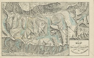
Français : "Map of the mountains and glaciers which surround the valley of Chamonix" publié en 1830 dans "Narrative of an Ascent to the Summit of Mont Blanc, on the 8th and 9th August, 1827" de John Auldjo |
| Date | |
| Source | https://secure.flickr.com/photos/britishlibrary/11007761535/ |
| Author | C. Ingrey |
Licensing
edit
|
This is a faithful photographic reproduction of a two-dimensional, public domain work of art. The work of art itself is in the public domain for the following reason:
The official position taken by the Wikimedia Foundation is that "faithful reproductions of two-dimensional public domain works of art are public domain".
This photographic reproduction is therefore also considered to be in the public domain in the United States. In other jurisdictions, re-use of this content may be restricted; see Reuse of PD-Art photographs for details. | ||||
File history
Click on a date/time to view the file as it appeared at that time.
| Date/Time | Thumbnail | Dimensions | User | Comment | |
|---|---|---|---|---|---|
| current | 17:59, 21 January 2014 | | 3,850 × 2,387 (2.18 MB) | Julien Demade (talk | contribs) | User created page with UploadWizard |
You cannot overwrite this file.
File usage on Commons
There are no pages that use this file.
File usage on other wikis
The following other wikis use this file:
- Usage on fr.wikipedia.org