File:Map of the north of Kerguelen - 1875 (Gazelle).jpg

Size of this preview: 601 × 600 pixels. Other resolutions: 241 × 240 pixels | 481 × 480 pixels | 770 × 768 pixels | 1,026 × 1,024 pixels | 2,053 × 2,048 pixels | 11,938 × 11,911 pixels.
Original file (11,938 × 11,911 pixels, file size: 15.91 MB, MIME type: image/jpeg)
Captions
Captions
Add a one-line explanation of what this file represents
Summary
edit.jpg&action=edit§ion=1)
| Warning | The original file is very high-resolution. It might not load properly or could cause your browser to freeze when opened at full size. |
|---|
.jpg&flash=no)
| Description |
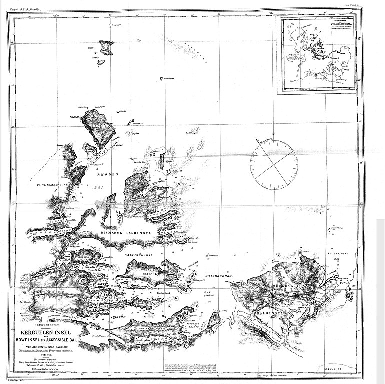
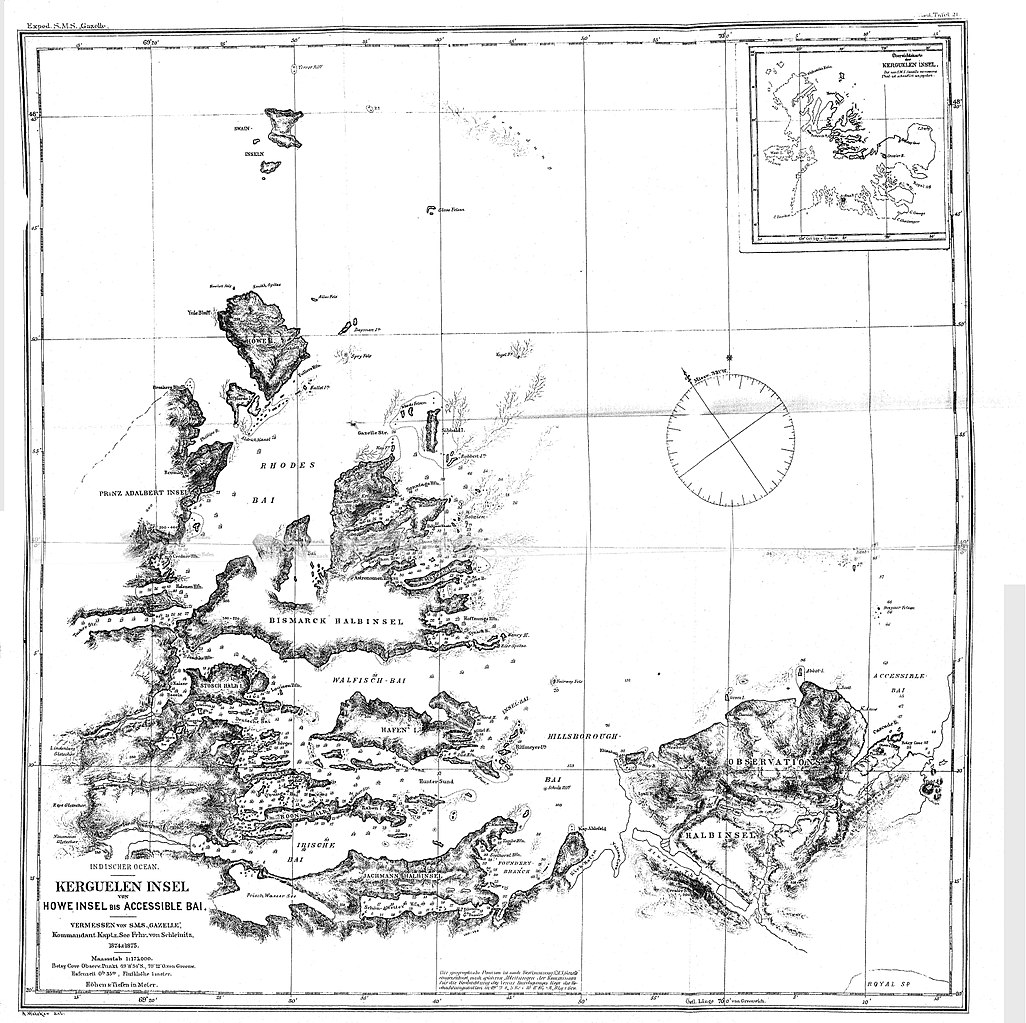
Français : carte du nord de Kerguelen dressée par l'expédition allemande de la Gazelle |
| Date | |
| Source |
https://edoc.hu-berlin.de/handle/18452/683 Die Forschungsreise S.M.S. "Gazelle" in den Jahren 1874 bis 1876 unter Kommando des Kapitän zur See Freiherrn von Schleinitz. 1.Theil, Der Reisebericht |
| Author | Georg von Schleinitz (1834-1910) |
Licensing
edit.jpg&action=edit§ion=2)
|
This work is in the public domain in its country of origin and other countries and areas where the copyright term is the author's life plus 70 years or fewer. This work is in the public domain in the United States because it was published (or registered with the U.S. Copyright Office) before January 1, 1929. | |
| This file has been identified as being free of known restrictions under copyright law, including all related and neighboring rights. | |
File history
Click on a date/time to view the file as it appeared at that time.
| Date/Time | Thumbnail | Dimensions | User | Comment | |
|---|---|---|---|---|---|
| current | 16:44, 20 July 2017 | | 11,938 × 11,911 (15.91 MB) | Channer (talk | contribs) | User created page with UploadWizard |
You cannot overwrite this file.
File usage on Commons
The following page uses this file:
File usage on other wikis
The following other wikis use this file:
- Usage on fr.wikipedia.org
.jpg&oldid=664240795)