File:Map of the states of Ohio, Indiana and Illinois- with the settled part of Michigan; engraved by J.H. Young - DPLA - 99f2ae8ae1a64770bfc73a18267875fe.jpg

Size of this preview: 740 × 599 pixels. Other resolutions: 296 × 240 pixels | 593 × 480 pixels | 1,000 × 810 pixels.
Original file (1,000 × 810 pixels, file size: 321 KB, MIME type: image/jpeg)
Captions
Captions
Add a one-line explanation of what this file represents
Summary
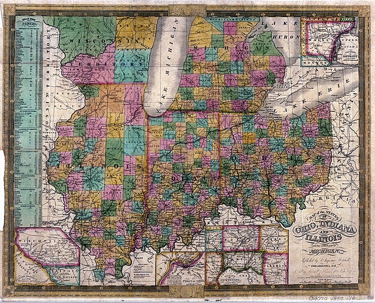
edit| Map of the states of Ohio, Indiana and Illinois: with the settled part of Michigan; engraved by J.H. Young
( |
|||||||||||||||||||||
|---|---|---|---|---|---|---|---|---|---|---|---|---|---|---|---|---|---|---|---|---|---|
| Creator | Mitchell, S. Augustus (Samuel Augustus), 1792-1868 | ||||||||||||||||||||
| Title |
Map of the states of Ohio, Indiana and Illinois: with the settled part of Michigan; engraved by J.H. Young |
||||||||||||||||||||
| Description |
1 map, colored; Vicinity of Cincinnati.; Washington.; Lead region east of the Mississippi River.; Vicinity of Detroit.; Includes table of Steam boat routes.; Falls of Ohio.; Sold by Mitchell & Hinman...; Scale ca. 1:2,100,000 |
||||||||||||||||||||
| Date | 1837 | ||||||||||||||||||||
| Collection |
|
||||||||||||||||||||
| Source/Photographer |
|
||||||||||||||||||||
| Permission (Reusing this file) |
|
||||||||||||||||||||
| Standardized rights statement |
|
||||||||||||||||||||


File history
Click on a date/time to view the file as it appeared at that time.
| Date/Time | Thumbnail | Dimensions | User | Comment | |
|---|---|---|---|---|---|
| current | 16:22, 4 November 2022 | | 1,000 × 810 (321 KB) | DPLA bot (talk | contribs) | Uploading DPLA ID 99f2ae8ae1a64770bfc73a18267875fe |
You cannot overwrite this file.
File usage on Commons
The following page uses this file: