File:Map showing the route of the Omaha tribe during the last bison hunt, 1876.png
Size of this preview: 738 × 600 pixels. Other resolutions: 295 × 240 pixels | 591 × 480 pixels | 945 × 768 pixels | 1,260 × 1,024 pixels | 2,305 × 1,873 pixels.
Original file (2,305 × 1,873 pixels, file size: 7.96 MB, MIME type: image/png)
Captions
Captions
Add a one-line explanation of what this file represents
Summary edit
| Description |
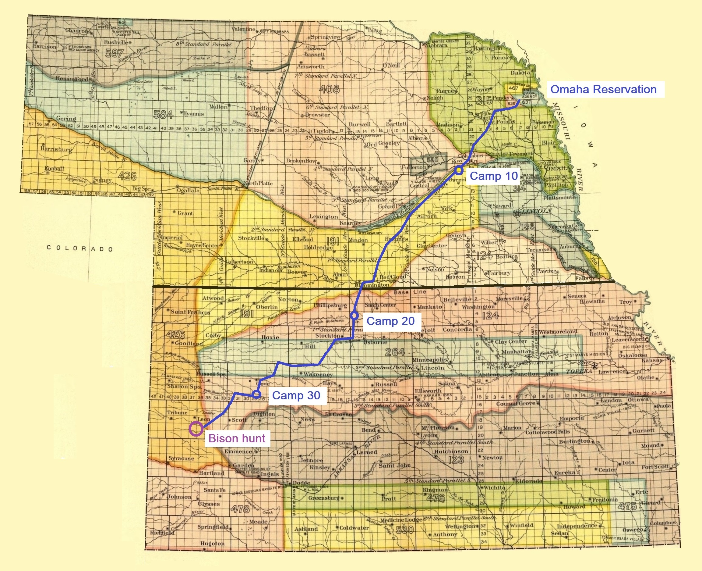
English: Itinerary of the last tribal hunt by the Omaha. Route drawn as described by Gilmore, Melvin R.: "Methods of Indian Buffalo Hunts, with the Itinerary of the last Tribal Hunt of the Omaha." |
| Date | |
| Source | Map: 18th Annual Report of the Bureau of American Ethnology. Part 2. 1896-'97. Washington, 1899. GPO . Route drawn as described by Gilmore |
| Author | Unknown author |
North America, U.S., Kansas, Nebraska, Omaha Indian Reservation
Licensing edit
This work is in the public domain in the United States because it is a work prepared by an officer or employee of the United States Government as part of that person’s official duties under the terms of Title 17, Chapter 1, Section 105 of the US Code.
Note: This only applies to original works of the Federal Government and not to the work of any individual U.S. state, territory, commonwealth, county, municipality, or any other subdivision. This template also does not apply to postage stamp designs published by the United States Postal Service since 1978. (See § 313.6(C)(1) of Compendium of U.S. Copyright Office Practices). It also does not apply to certain US coins; see The US Mint Terms of Use.
|
 | |
| This file has been identified as being free of known restrictions under copyright law, including all related and neighboring rights. | ||
File history
Click on a date/time to view the file as it appeared at that time.
| Date/Time | Thumbnail | Dimensions | User | Comment | |
|---|---|---|---|---|---|
| current | 07:15, 25 November 2017 | | 2,305 × 1,873 (7.96 MB) | Naawada2016 (talk | contribs) | User created page with UploadWizard |
You cannot overwrite this file.
File usage on Commons
The following page uses this file:
File usage on other wikis
The following other wikis use this file:
- Usage on da.wikipedia.org
- Usage on en.wikipedia.org