File:MapaGuayasPoliticoSageo.JPG

Size of this preview: 539 × 600 pixels. Other resolutions: 216 × 240 pixels | 432 × 480 pixels | 882 × 981 pixels.
Original file (882 × 981 pixels, file size: 96 KB, MIME type: image/jpeg)
Captions
Captions
Add a one-line explanation of what this file represents
Summary
edit
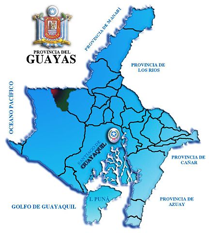
| Description | Politic Division of the ecuadorian Province of Guayas |
| Date | |
| Source | Own work |
| Author | Salomón Villacrés (Sageo) |
| Permission (Reusing this file) |
Licencia dual bajo la GFDL y CC-By-SA-2.5, 2.0, y 1.0 |
Licensing
edit
| This work has been released into the public domain by its author, I, Sageo. This applies worldwide. In some countries this may not be legally possible; if so: I, Sageo grants anyone the right to use this work for any purpose, without any conditions, unless such conditions are required by law. |
File history
Click on a date/time to view the file as it appeared at that time.
| Date/Time | Thumbnail | Dimensions | User | Comment | |
|---|---|---|---|---|---|
| current | 15:16, 26 June 2007 | | 882 × 981 (96 KB) | Sageo (talk | contribs) | {{Information |Description= Politic Division of the ecuadorian Province of Guayas |Source= "Own Work" |Date= 2007-06-26 |Author= Salomón Villacrés (Sageo) |Permission= Licencia dual bajo la GFDL y CC-By-SA-2.5, 2.0, y 1.0 |other_versions= |
You cannot overwrite this file.
File usage on Commons
There are no pages that use this file.
File usage on other wikis
The following other wikis use this file:
- Usage on es.wikipedia.org