File:Mapa Comarca.png
Size of this preview: 800 × 450 pixels. Other resolutions: 320 × 180 pixels | 640 × 360 pixels | 1,024 × 576 pixels | 1,366 × 768 pixels.
Original file (1,366 × 768 pixels, file size: 172 KB, MIME type: image/png)
Captions
Captions
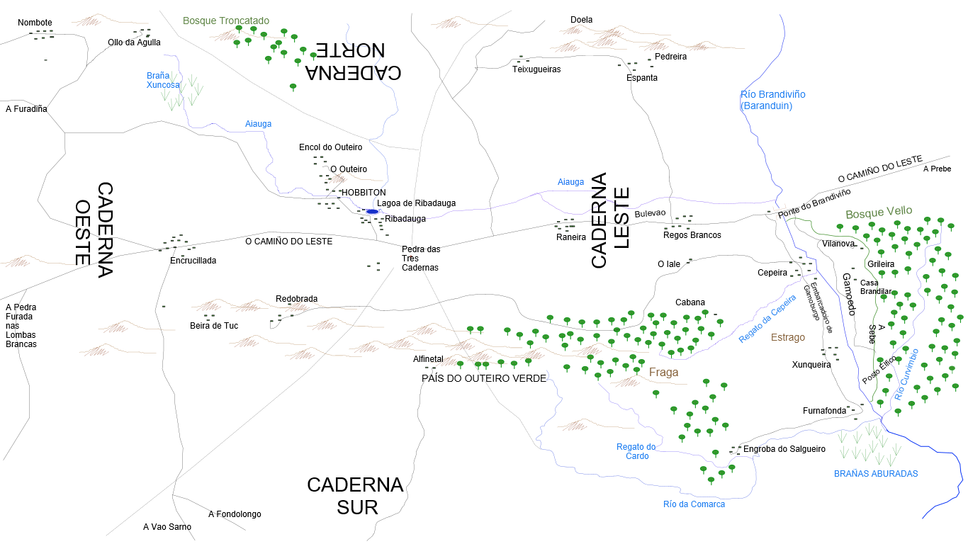
A map of The Shire translated into Galician. Contains main towns, forests and water courses.
Summary edit
| Description |
Galego: Mapa da Comarca |
| Date | |
| Source | File:Sketch Map of The Shire.svg |
| Author | gl:User:Manudosde, original of gl:User:Chiswick Chap |
| Permission (Reusing this file) |
This file is licensed under the Creative Commons Attribution-Share Alike 4.0 International license.
|
File history
Click on a date/time to view the file as it appeared at that time.
| Date/Time | Thumbnail | Dimensions | User | Comment | |
|---|---|---|---|---|---|
| current | 23:10, 12 October 2022 | | 1,366 × 768 (172 KB) | Manudosde (talk | contribs) | {{Information |Description= Mapa da Comarca |Source= Chiswick Chap, CC BY-SA 4.0 <https://creativecommons.org/licenses/by-sa/4.0>, via Wikimedia Commons |Date= 13/10/22 |Author= Chiswick Chap |Permission= Creative Commons |other_versions= |additional_information= }} |
You cannot overwrite this file.
File usage on Commons
There are no pages that use this file.
File usage on other wikis
The following other wikis use this file:
- Usage on gl.wikipedia.org