File:Mapa Gran Canaria Siglo xviii.jpg

Size of this preview: 669 × 599 pixels. Other resolutions: 268 × 240 pixels | 536 × 480 pixels | 718 × 643 pixels.
Original file (718 × 643 pixels, file size: 593 KB, MIME type: image/jpeg)
Captions
Captions
Add a one-line explanation of what this file represents
Summary
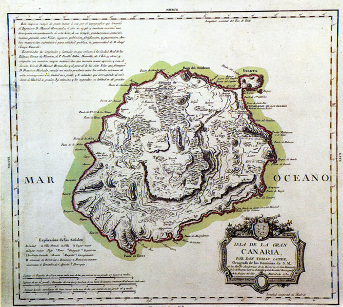
edit| Description | Mapa de Gran Canaria del siglo XVIII | ||||||||||||||||||||
| Date | 18th century | ||||||||||||||||||||
| Source | pd old | ||||||||||||||||||||
| Author |
|
||||||||||||||||||||
| Permission (Reusing this file) |
pd old | ||||||||||||||||||||
_Tom%C3%A1s_L%C3%B3pez.jpg)
Licensing
edit
|
This is a faithful photographic reproduction of a two-dimensional, public domain work of art. The work of art itself is in the public domain for the following reason:
The official position taken by the Wikimedia Foundation is that "faithful reproductions of two-dimensional public domain works of art are public domain".
This photographic reproduction is therefore also considered to be in the public domain in the United States. In other jurisdictions, re-use of this content may be restricted; see Reuse of PD-Art photographs for details. | ||||
File history
Click on a date/time to view the file as it appeared at that time.
| Date/Time | Thumbnail | Dimensions | User | Comment | |
|---|---|---|---|---|---|
| current | 20:29, 28 October 2007 | | 718 × 643 (593 KB) | Alavisan (talk | contribs) | {{Information |Description= Mapa de Gran Canaria del siglo XVIII |Source={{pd old}} |Date= siglo XVIII |Author= Tomás López |Permission={{pd old}} |other_versions= }} |
You cannot overwrite this file.
File usage on Commons
The following page uses this file:
File usage on other wikis
The following other wikis use this file:
- Usage on es.wikipedia.org
- Usage on uk.wikipedia.org