File:Mapa Lotyšska.jpg
No higher resolution available.
Mapa_Lotyšska.jpg (655 × 335 pixels, file size: 58 KB, MIME type: image/jpeg)
Captions
Captions
Add a one-line explanation of what this file represents
Summary
edit
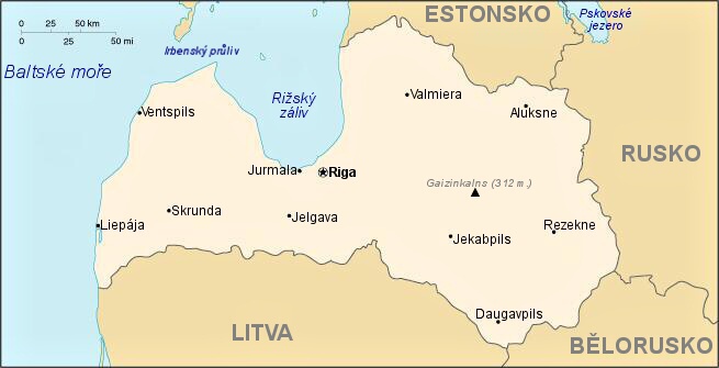
| Description |
Čeština: Orientační mapa Lotyšska. |
| Date | 7. 6. 2009 |
| Source | Own work |
| Author | STS Chvojkovice-Brod |
Licensing
edit
| I, the copyright holder of this work, release this work into the public domain. This applies worldwide. In some countries this may not be legally possible; if so: I grant anyone the right to use this work for any purpose, without any conditions, unless such conditions are required by law. |
File history
Click on a date/time to view the file as it appeared at that time.
| Date/Time | Thumbnail | Dimensions | User | Comment | |
|---|---|---|---|---|---|
| current | 10:23, 7 June 2009 | | 655 × 335 (58 KB) | STS Chvojkovice-Brod (talk | contribs) | |
| 09:40, 7 June 2009 |  | 655 × 335 (57 KB) | STS Chvojkovice-Brod (talk | contribs) | {{Information |Description={{cs|1=Orientační mapa Lotyšska.}} |Source=Vlastní dílo (own work) |Author=STS Chvojkovice-Brod |Date=7. 6. 2009 |Permission= |other_versions= }} <!--{{ImageUpload|full}}--> [[Category:Maps of |
You cannot overwrite this file.
File usage on Commons
There are no pages that use this file.