File:Mapa Terra do Gentio Cayapó.jpg
Size of this preview: 483 × 599 pixels. Other resolutions: 193 × 240 pixels | 387 × 480 pixels | 619 × 768 pixels | 826 × 1,024 pixels | 1,652 × 2,048 pixels | 3,544 × 4,394 pixels.
Original file (3,544 × 4,394 pixels, file size: 4.04 MB, MIME type: image/jpeg)
Captions
Captions
Add a one-line explanation of what this file represents
Summary edit
| Description |
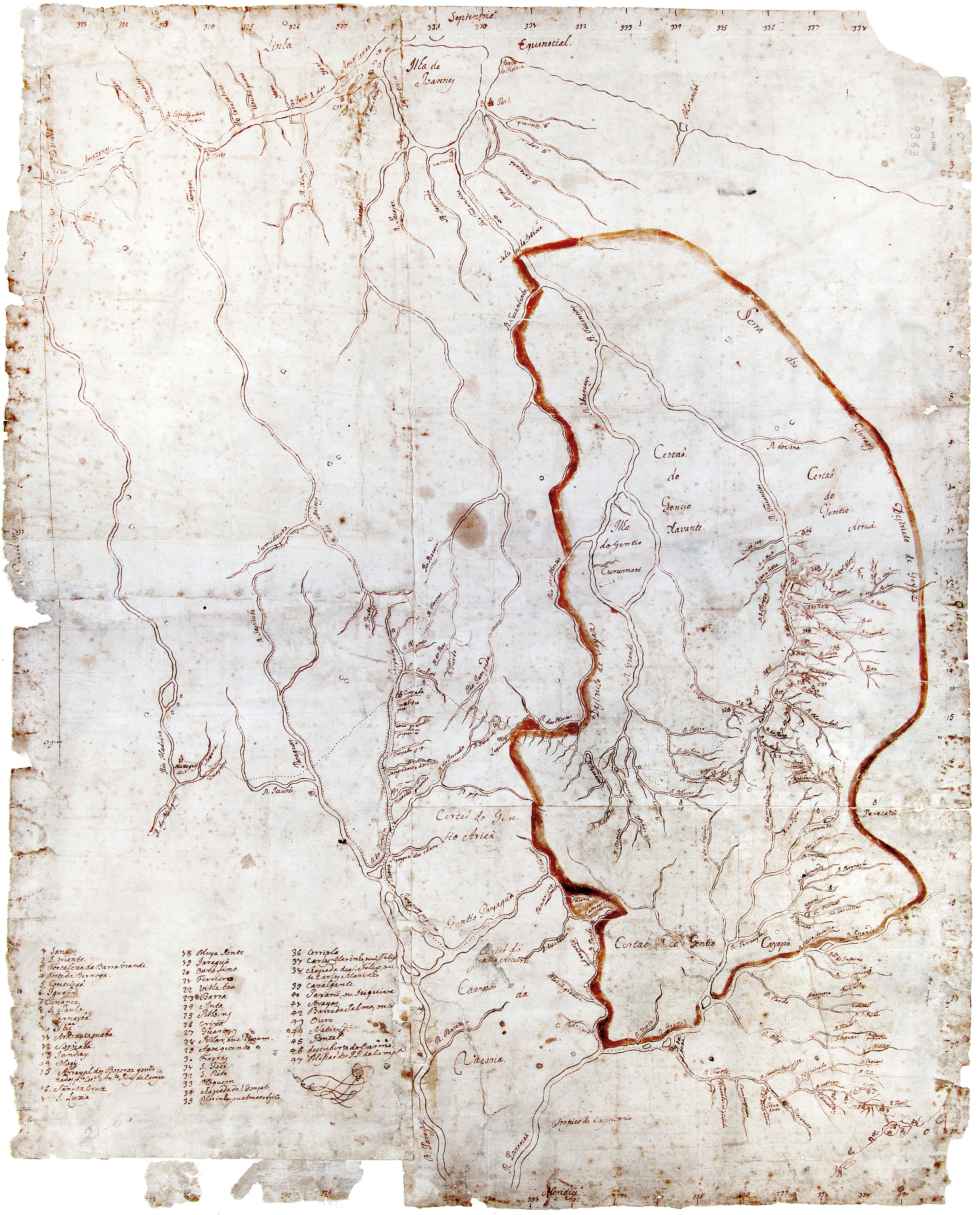
Português: Assinala os limites de Goiás que, do lado ocidental, estão traçados pelo Rio das Mortes, desde as suas cabeceiras até as proximidades da confluência com o Araguaia, e pelo divisor de águas até as nascentes do Itacaiúnas. Essa configuração das fronteiras de “Goyaz” era a proposta de Dom Marcos de Noronha, Conde dos Arcos, primeiro governador e Capitão-General da Capitania de Goiás (1749–1754), apresentada em ofício encaminhado em 12 de janeiro de 1750 ao Governo português. Mostra igualmente as comunicações entre as bacias do Prata e do Amazonas.1 |
| Date | |
| Source | https://www.arquivopublico.df.gov.br/wp-content/uploads/2018/03/01_MI.jpg |
| Author | Autor não identificado. Fonte – Mapoteca do Itamaraty |
Licensing edit
|
This is a faithful photographic reproduction of a two-dimensional, public domain work of art. The work of art itself is in the public domain for the following reason:
The official position taken by the Wikimedia Foundation is that "faithful reproductions of two-dimensional public domain works of art are public domain".
This photographic reproduction is therefore also considered to be in the public domain in the United States. In other jurisdictions, re-use of this content may be restricted; see Reuse of PD-Art photographs for details. | ||||
File history
Click on a date/time to view the file as it appeared at that time.
| Date/Time | Thumbnail | Dimensions | User | Comment | |
|---|---|---|---|---|---|
| current | 22:41, 7 July 2022 | | 3,544 × 4,394 (4.04 MB) | DanielaMilagres (talk | contribs) | Uploaded a work by Autor não identificado. Fonte – Mapoteca do Itamaraty from https://www.arquivopublico.df.gov.br/wp-content/uploads/2018/03/01_MI.jpg with UploadWizard |
You cannot overwrite this file.
File usage on Commons
There are no pages that use this file.
File usage on other wikis
The following other wikis use this file:
- Usage on en.wikipedia.org
- Usage on pt.wikipedia.org