File:Mapa da "Capitania do Espíritu Sancto" provavelmente feito entre 1608-1616 pelo arquiteto e engenheiro italiano Alexandre Massaii.jpg
Size of this preview: 800 × 548 pixels. Other resolutions: 320 × 219 pixels | 640 × 439 pixels | 1,024 × 702 pixels | 1,280 × 877 pixels | 1,920 × 1,316 pixels.
Original file (1,920 × 1,316 pixels, file size: 819 KB, MIME type: image/jpeg)
Captions
Captions
Add a one-line explanation of what this file represents
Summary
edit
| Description |
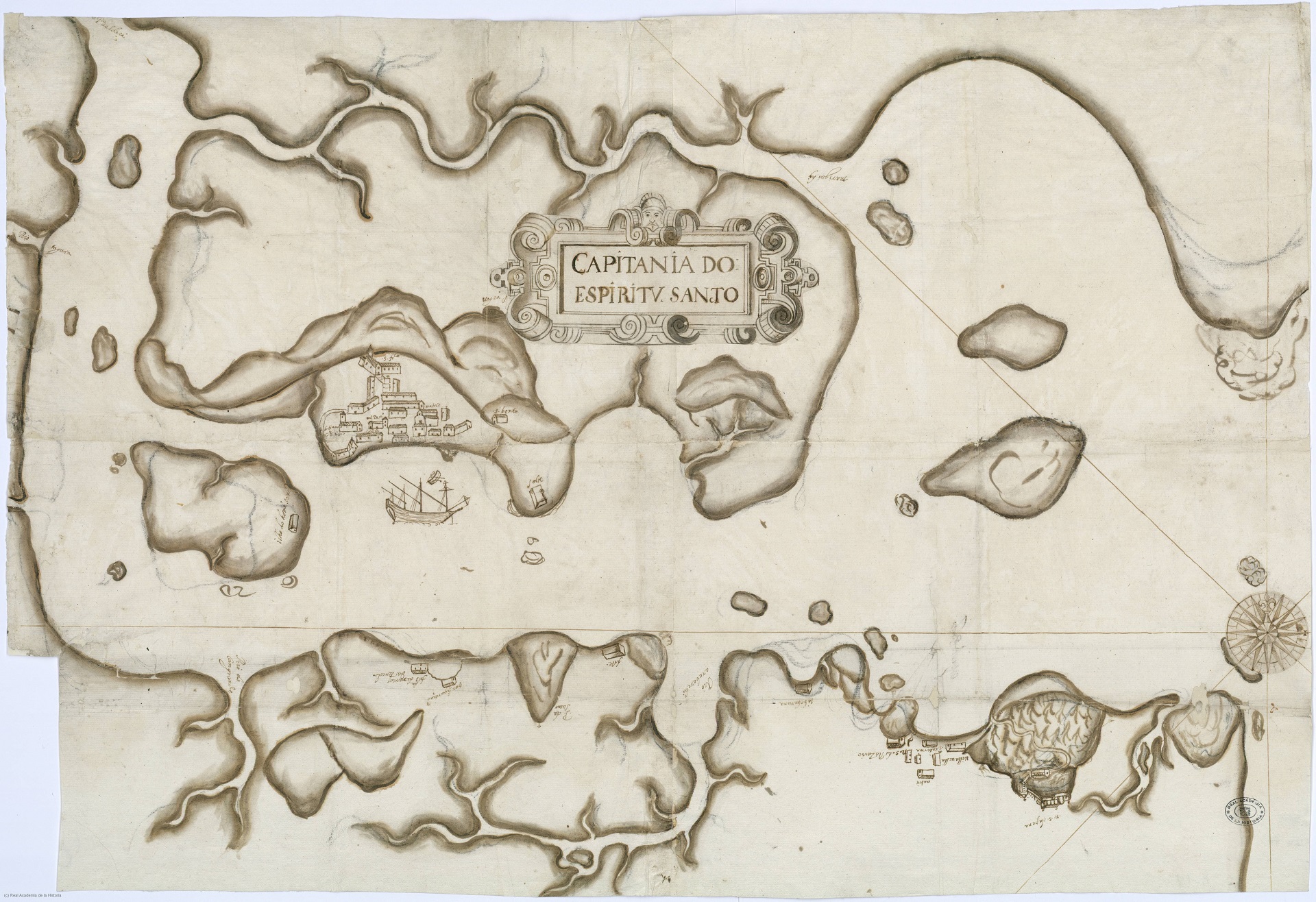
Português: Mapa da "Capitania do Espíritu Sancto" provavelmente feito entre 1608-1616 pelo arquiteto e engenheiro italiano Alexandre Massaii. Este mapa traz, pela primeira vez, o que temos de mais próximo a uma planta das Vilas de Vitória e do Espírito Santo, no período colonial |
| Date | |
| Source | https://historiacapixaba.com/documentos/capitania-do-espiritu-sancto-1608-1616/ |
| Author | Alexandre Massaii |
Licensing
edit
This work is in the public domain in the United States because it was published (or registered with the U.S. Copyright Office) before January 1, 1929.
Public domain works must be out of copyright in both the United States and in the source country of the work in order to be hosted on the Commons. If the work is not a U.S. work, the file must have an additional copyright tag indicating the copyright status in the source country.
Note: This tag should not be used for sound recordings. |
File history
Click on a date/time to view the file as it appeared at that time.
| Date/Time | Thumbnail | Dimensions | User | Comment | |
|---|---|---|---|---|---|
| current | 20:18, 4 July 2022 | | 1,920 × 1,316 (819 KB) | Fabiopaivareis (talk | contribs) | Uploaded a work by Alexandre Massaii from https://historiacapixaba.com/documentos/capitania-do-espiritu-sancto-1608-1616/ with UploadWizard |
You cannot overwrite this file.
File usage on Commons
There are no pages that use this file.