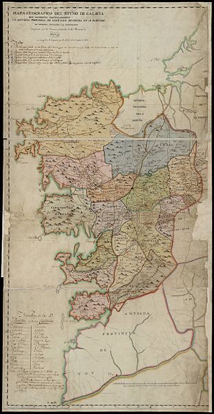
File:Mapa da antiga provincia de Santiago (Reino de Galicia) e proposta de división en partidos xudicias (1813).jpg
Original file(3,094 × 5,978 pixels, file size: 2.37 MB, MIME type: image/jpeg)

Captions

Captions

Add a one-line explanation of what this file represents

Summary edit

Description
Galego: Mapa da provincia de Santiago (Reino de Galicia) no que aparece a proposta da comisión particular desa provincia a respecto do proxecto de división en partidos xudiciais de 1813, establecido no marco lexislativo derivado da implantación da constitución española de 1812. Presentado por Luis López Ballesteros ante a Audiencia de Galicia o 13 de outubro de 1813.
Date
Source Mapa geográfico del Reyno de Galicia que manifiesta particularmente la antigua provincia de Santiago dividida en 13 partidos de primera instancia y 2 incompletos : dispuesto por la Comisión particular de la Provincia de Santiago con arreglo a lo dispuesto por la ley de 9 de Octubre de 1812 at
institution QS:P195,Q18596294
Author Luis López Ballesteros

Licensing edit

Public domain

This work is in the public domain in its country of origin and other countries and areas where the copyright term is the author's life plus 100 years or fewer.


This work is in the public domain in the United States because it was published (or registered with the U.S. Copyright Office) before January 1, 1929.

File history

Click on a date/time to view the file as it appeared at that time.

Date/TimeThumbnailDimensionsUserComment
current06:35, 26 March 2016Thumbnail for version as of 06:35, 26 March 20163,094 × 5,978 (2.37 MB)Xavier36 (talk | contribs)User created page with UploadWizard

The following page uses this file:

File usage on other wikis

The following other wikis use this file: