File:Mapa de Barranquilla de Ernest Thevenin.png
Size of this preview: 800 × 400 pixels. Other resolutions: 320 × 160 pixels | 640 × 320 pixels | 1,025 × 512 pixels.
Original file (1,025 × 512 pixels, file size: 690 KB, MIME type: image/png)
Captions
Captions
Add a one-line explanation of what this file represents
Summary
edit
| Description |
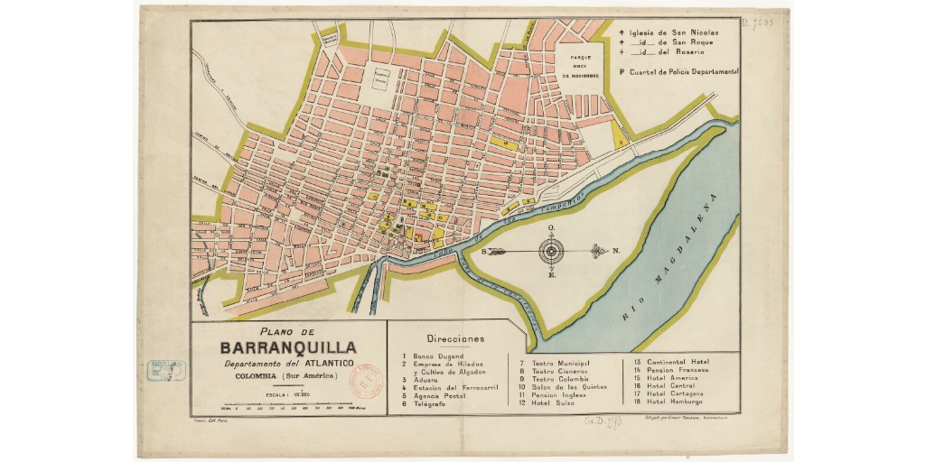
Español: Este mapa muestra cómo estaba organizada Barranquilla a comienzos del siglo XX, aproximadamente en la segunda mitad de la década de 1910. |
| Date | |
| Source | https://gallica.bnf.fr/ark:/12148/btv1b84464524/f1.item.r=Colombia.zoom |
| Author | Enest Thévenin |
Licensing
edit
This file is licensed under the Creative Commons Attribution-Share Alike 4.0 International license.
- You are free:
- to share – to copy, distribute and transmit the work
- to remix – to adapt the work
- Under the following conditions:
- attribution – You must give appropriate credit, provide a link to the license, and indicate if changes were made. You may do so in any reasonable manner, but not in any way that suggests the licensor endorses you or your use.
- share alike – If you remix, transform, or build upon the material, you must distribute your contributions under the same or compatible license as the original.
File history
Click on a date/time to view the file as it appeared at that time.
| Date/Time | Thumbnail | Dimensions | User | Comment | |
|---|---|---|---|---|---|
| current | 00:24, 19 April 2023 | | 1,025 × 512 (690 KB) | Roberto José Carmona (talk | contribs) | Uploaded a work by Enest Thévenin from https://gallica.bnf.fr/ark:/12148/btv1b84464524/f1.item.r=Colombia.zoom with UploadWizard |
You cannot overwrite this file.
File usage on Commons
There are no pages that use this file.
File usage on other wikis
The following other wikis use this file:
- Usage on es.wikipedia.org