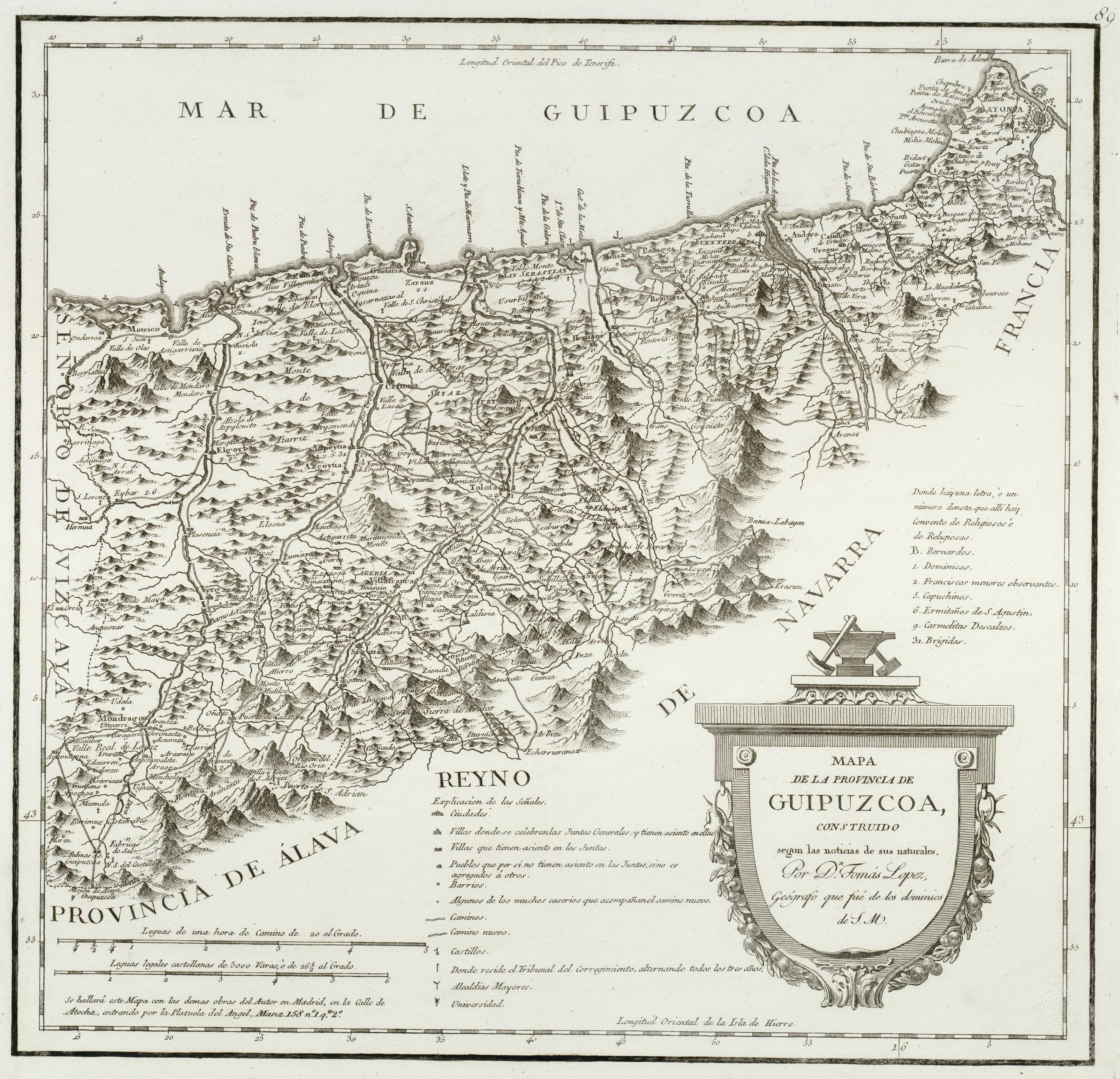
File:Mapa de la provincia de Guipuzcoa (1744-1746, Tomás López).jpg
Original file (3,165 × 3,049 pixels, file size: 5.79 MB, MIME type: image/jpeg)
Captions
Captions
| Description |
Español: Mapa de la Provincia de Guipuzcoa |
|||||||||||||||||||
| Date | 1744-1746 (reimprinted around 1814-1816) | |||||||||||||||||||
| Source | Guipúzcoa (Provincia). Mapas generales. 1816-1818 (1844-1846 | |||||||||||||||||||
| Author |
reimprinted by his son Juan López (1765-1825) |
|||||||||||||||||||
| Permission (Reusing this file) |
|
|||||||||||||||||||
| Other versions | ||||||||||||||||||||


File history
Click on a date/time to view the file as it appeared at that time.
| Date/Time | Thumbnail | Dimensions | User | Comment | |
|---|---|---|---|---|---|
| current | 12:27, 3 September 2014 | | 3,165 × 3,049 (5.79 MB) | Asqueladd (talk | contribs) | cropped |
| 12:22, 3 September 2014 |  | 5,028 × 3,439 (1.92 MB) | Asqueladd (talk | contribs) | {{Information |Description={{es|1=Mapa de la Provincia de Guipuzcoa}} |Source=[http://bibliotecadigital.rah.es/dgbrah/es/consulta/registro.cmd?id=12640 Toledo (Provincia). Mapas generales. 1768 ] |Date=1844-1846 (reimprinted around 1814-1816) |Author={... |
You cannot overwrite this file.
File usage on Commons
The following page uses this file:
File usage on other wikis
The following other wikis use this file:
- Usage on es.wikipedia.org
.jpg&oldid=857564092)