File:Mapa del Perú (1913).jpg

Original file (7,205 × 10,484 pixels, file size: 10.65 MB, MIME type: image/jpeg)
Captions
Captions
Summary
edit| Description |
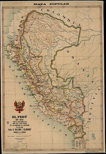
Español: Mapa del Perú de 1913, trazado por la Sociedad Geográfica de Lima, publicado por el gobierno de Guillermo Billingurst |
| Date | |
| Source | http://www.bne.es/es/Micrositios/Guias/12Octubre/MapasAmerica/GaleriaMapas/DetalleImagen25.html |
| Author | Sociedad Geográfica de Lima |
| Other versions |
_(cropped).jpg)
Licensing
editThis work is in the public domain in its source country for the following reason:
This work is in the public domain in the United States for the following reason:
| |||||
| This file has been identified as being free of known restrictions under copyright law, including all related and neighboring rights. |

.jpg&action=edit§ion=1)
.jpg&action=edit§ion=2)
File history
Click on a date/time to view the file as it appeared at that time.
| Date/Time | Thumbnail | Dimensions | User | Comment | |
|---|---|---|---|---|---|
| current | 17:33, 15 May 2015 | | 7,205 × 10,484 (10.65 MB) | Luisedwin2105 (talk | contribs) | Tamaño aumentado |
| 18:36, 1 November 2014 |  | 650 × 958 (143 KB) | Luisedwin2105 (talk | contribs) | User created page with UploadWizard |
You cannot overwrite this file.
File usage on Commons
The following page uses this file:
File usage on other wikis
The following other wikis use this file:
- Usage on en.wikipedia.org
- Usage on es.wikipedia.org
- Usage on gl.wikipedia.org
- Usage on mt.wikipedia.org
.jpg&oldid=752643715)