File:Mapa indígena.png
Size of this preview: 667 × 600 pixels. Other resolutions: 267 × 240 pixels | 534 × 480 pixels | 854 × 768 pixels | 1,200 × 1,079 pixels.
Original file (1,200 × 1,079 pixels, file size: 151 KB, MIME type: image/png)
Captions
Captions
Add a one-line explanation of what this file represents
Summary
edit
| Description |
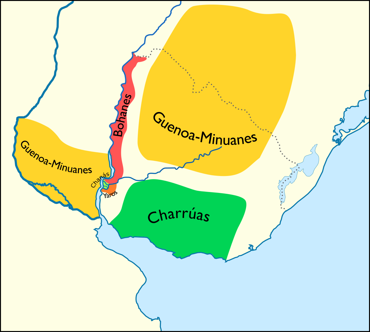
Español: Mapa de los territorios ocupados por algunos grupos indígenas del Río de la Plata al momento de la llegada de los conquistadores españoles. Construido según la descripción de Félix de Azara (1742-1821) en su "Descripción e historia del Paraguay y del Río de la Plata"
English: Map of indigenous territories according to Félix de Azara |
| Date | |
| Source | Own work |
| Author | Coquimbo58 |
Licensing
edit
I, the copyright holder of this work, hereby publish it under the following license:
This file is licensed under the Creative Commons Attribution-Share Alike 4.0 International license.
- You are free:
- to share – to copy, distribute and transmit the work
- to remix – to adapt the work
- Under the following conditions:
- attribution – You must give appropriate credit, provide a link to the license, and indicate if changes were made. You may do so in any reasonable manner, but not in any way that suggests the licensor endorses you or your use.
- share alike – If you remix, transform, or build upon the material, you must distribute your contributions under the same or compatible license as the original.
File history
Click on a date/time to view the file as it appeared at that time.
| Date/Time | Thumbnail | Dimensions | User | Comment | |
|---|---|---|---|---|---|
| current | 17:50, 24 January 2021 | | 1,200 × 1,079 (151 KB) | Coquimbo58 (talk | contribs) | minor changes |
| 17:40, 24 January 2021 |  | 1,170 × 949 (135 KB) | Coquimbo58 (talk | contribs) | Uploaded own work with UploadWizard |
You cannot overwrite this file.
File usage on Commons
The following 3 pages use this file:
File usage on other wikis
The following other wikis use this file:
- Usage on en.wikipedia.org
- Usage on es.wikipedia.org
- Usage on gl.wikipedia.org
- Usage on pt.wikipedia.org
- Usage on www.wikidata.org