File:Mapa stredoafricke rep.png
No higher resolution available.
Mapa_stredoafricke_rep.png (325 × 349 pixels, file size: 11 KB, MIME type: image/png)
Captions
Captions
Add a one-line explanation of what this file represents
Summary edit
| Description |
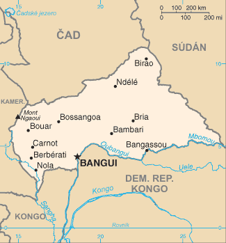
Čeština: Mapa Středoafrické republiky s českými popisky.
English: Map of Central African Republic with Czech description. |
| Date | 7 July 2006 (original upload date) |
| Source |
|
| Author | Original uploader was Nádvorník at cs.wikipedia |
Licensing edit
This image is in the public domain because it contains materials that originally came from the United States Central Intelligence Agency's World Factbook.
|
 |
Original upload log edit
The original description page was here. All following user names refer to cs.wikipedia.
- 2006-07-07 14:41 Nádvorník 326×350×4 (13650 bytes) Mapa [[StÅedoafrická republika|StÅedoafrické republiky]] - pÅeložená mapa z CIA World Factbook.
File history
Click on a date/time to view the file as it appeared at that time.
| Date/Time | Thumbnail | Dimensions | User | Comment | |
|---|---|---|---|---|---|
| current | 22:10, 24 June 2008 | | 325 × 349 (11 KB) | Sevela.p (talk | contribs) | remove frame |
| 22:00, 24 June 2008 |  | 326 × 350 (13 KB) | File Upload Bot (Magnus Manske) (talk | contribs) | {{BotMoveToCommons|cs.wikipedia}} {{Information |Description={{cs|Mapa StÅedoafrické republiky - pÅeložená mapa z CIA World Factbook.}} |Source=Transferred from [http://cs.wikipedia.org cs.wikipedia]; |
You cannot overwrite this file.
File usage on Commons
The following page uses this file:
File usage on other wikis
The following other wikis use this file:
- Usage on cs.wikipedia.org