File:Mappa Mundi generalis, 1753.jpg

Size of this preview: 800 × 582 pixels. Other resolutions: 320 × 233 pixels | 640 × 466 pixels | 1,024 × 745 pixels | 1,280 × 931 pixels | 2,560 × 1,862 pixels | 5,167 × 3,759 pixels.
Original file (5,167 × 3,759 pixels, file size: 5.29 MB, MIME type: image/jpeg)
Captions
Captions
Add a one-line explanation of what this file represents
Summary
edit
| Description |
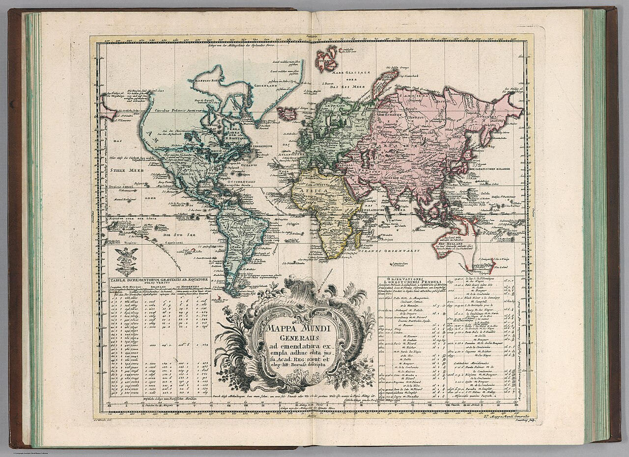
English: Hand colored copperplate engraving map on 2 sheets. Shows North America the Northwest coast is blank and a river provides passage between the Great Lakes and the Pacific. Australia and New Zealand are depicted with partially completed coastlines. Relief shown pictorially. Prime meridian is Ferro. Includes two large explanation tables. |
| Date | |
| Source | https://www.davidrumsey.com/luna/servlet/detail/RUMSEY~8~1~290912~90062577:Mappa-Mundi-generalis# |
| Author | Leonhard Euler |
Licensing
edit
This file is licensed under the Creative Commons Attribution-Share Alike 3.0 Unported license.
- You are free:
- to share – to copy, distribute and transmit the work
- to remix – to adapt the work
- Under the following conditions:
- attribution – You must give appropriate credit, provide a link to the license, and indicate if changes were made. You may do so in any reasonable manner, but not in any way that suggests the licensor endorses you or your use.
- share alike – If you remix, transform, or build upon the material, you must distribute your contributions under the same or compatible license as the original.
File history
Click on a date/time to view the file as it appeared at that time.
| Date/Time | Thumbnail | Dimensions | User | Comment | |
|---|---|---|---|---|---|
| current | 18:50, 10 December 2021 | | 5,167 × 3,759 (5.29 MB) | Universalis (talk | contribs) | Uploaded a work by Leonhard Euler from https://www.davidrumsey.com/luna/servlet/detail/RUMSEY~8~1~290912~90062577:Mappa-Mundi-generalis# with UploadWizard |
You cannot overwrite this file.
File usage on Commons
There are no pages that use this file.