File:Maraş-Graben 09 1973 Kürt Dağı.jpg

Size of this preview: 800 × 527 pixels. Other resolutions: 320 × 211 pixels | 640 × 422 pixels | 1,024 × 675 pixels | 1,280 × 844 pixels | 2,651 × 1,748 pixels.
Original file (2,651 × 1,748 pixels, file size: 1.59 MB, MIME type: image/jpeg)
Captions
Captions
Add a one-line explanation of what this file represents
Summary edit
| Description |
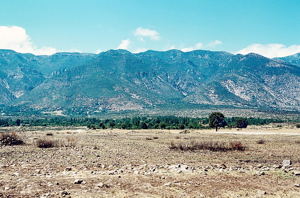
Deutsch: Zwischen den Gavur Dağları und der östlicheren niedrigen Bergkette der Kürt Dağları (hier im Bild) liegt der tektonische Maraş-Graben, der von Maraş bis zur Amik-Ebene im Süden bei Antakya reicht. Dort hatten turkmenische und kurdische Stämme im 19. Jahrhundert ihre Winterlager, die Reyhanlı-Turkmenen in der Amik-Ebene, die kurdischen Delikanlı und Celikanlı im Norden in der Dumdum-Ebene. |
| Date | |
| Source | Own work |
| Author | Volker Höhfeld |
Licensing edit
I, the copyright holder of this work, hereby publish it under the following license:
This file is licensed under the Creative Commons Attribution-Share Alike 4.0 International license.
- You are free:
- to share – to copy, distribute and transmit the work
- to remix – to adapt the work
- Under the following conditions:
- attribution – You must give appropriate credit, provide a link to the license, and indicate if changes were made. You may do so in any reasonable manner, but not in any way that suggests the licensor endorses you or your use.
- share alike – If you remix, transform, or build upon the material, you must distribute your contributions under the same or compatible license as the original.
File history
Click on a date/time to view the file as it appeared at that time.
| Date/Time | Thumbnail | Dimensions | User | Comment | |
|---|---|---|---|---|---|
| current | 15:53, 22 August 2021 | | 2,651 × 1,748 (1.59 MB) | Volker Höhfeld (talk | contribs) | Uploaded own work with UploadWizard |
You cannot overwrite this file.
File usage on Commons
There are no pages that use this file.
File usage on other wikis
The following other wikis use this file:
- Usage on de.wikipedia.org