File:Maricopa County Incorporated and Planning areas April 2008.png
No higher resolution available.
Maricopa_County_Incorporated_and_Planning_areas_April_2008.png (675 × 600 pixels, file size: 64 KB, MIME type: image/png)
Captions
Captions
Add a one-line explanation of what this file represents
Summary
edit
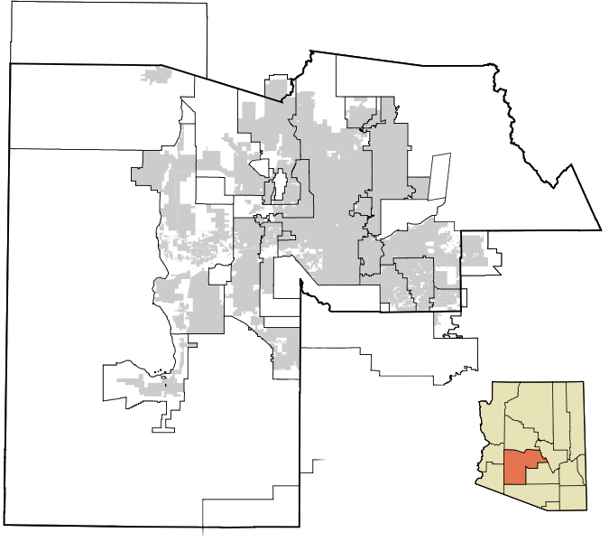
| Description | Some changes in some of the West Valley cities' boundaries since the production of the last images (Buckeye, Gila Bend, Avondale, and Surprise have all changed) |
| Source | Own work |
| Author | Node ue |
Licensing
edit
| I, the copyright holder of this work, release this work into the public domain. This applies worldwide. In some countries this may not be legally possible; if so: I grant anyone the right to use this work for any purpose, without any conditions, unless such conditions are required by law. |
File history
Click on a date/time to view the file as it appeared at that time.
| Date/Time | Thumbnail | Dimensions | User | Comment | |
|---|---|---|---|---|---|
| current | 08:56, 31 March 2008 | | 675 × 600 (64 KB) | Node ue (talk | contribs) | {{Information |Description= |Source=self-made |Date= |Author= Node ue |Permission= |other_versions= }} |
You cannot overwrite this file.
File usage on Commons
The following page uses this file: