File:Marina City Towers, Chicago, Illinois (42659470154).jpg

Original file (4,000 × 3,000 pixels, file size: 4.16 MB, MIME type: image/jpeg)
Captions
Captions
Summary edit
.jpg&action=edit§ion=1)
| Description |
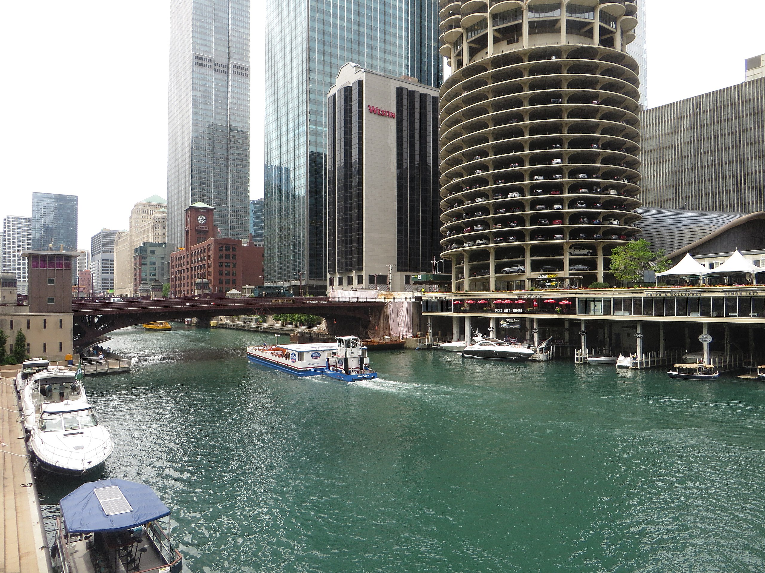
Marina City is a mixed-use residential/commercial building complex occupying an entire city block on State Street in Chicago, Illinois. It lies on the north bank of the Chicago River in downtown Chicago, directly across from the Loop district. The complex consists of two high rise corncob-shaped 65-story towers (including five-story elevator and physical plant penthouse), at 587-foot (179 m) tall. It also includes a saddle-shaped auditorium building, and a mid-rise hotel building, all contained on a raised platform adjacent to the Chicago River. Beneath the raised platform at river level is a small marina for pleasure craft, giving the structures their name. Marina City is notable in that it is the first building in the United States to be constructed with tower cranes. The Marina City complex was designed in 1959 by architect Bertrand Goldberg and completed in 1964 at a cost of $36 million financed to a large extent by the union of building janitors and elevator operators, who sought to reverse the pattern of white flight from the city's downtown area. When finished, the two towers were both the tallest residential buildings and the tallest reinforced concrete structures in the world. The complex was built as a city within a city, featuring numerous on-site facilities including a theatre, gym, swimming pool, ice rink, bowling alley, several stores and restaurants, and, of course, a marina. Marina City was the first urban post-war high-rise residential complex in the United States and is widely credited with beginning the residential renaissance of American inner cities. Its model of mixed residential and office uses and high-rise towers with a base of parking has become a primary model for urban development in the United States and throughout the world, and has been widely copied throughout many cities internationally. Marina City construction employed the first tower crane used in the United States. <a href="http://en.wikipedia.org/wiki/Marina_City" rel="noreferrer nofollow">en.wikipedia.org/wiki/Marina_City</a> <a href="http://en.wikipedia.org/wiki/Wikipedia:Text_of_Creative_Commons_Attribution-ShareAlike_3.0_Unported_License" rel="noreferrer nofollow">en.wikipedia.org/wiki/Wikipedia:Text_of_Creative_Commons_...</a> |
| Date | |
| Source | Marina City Towers, Chicago, Illinois |
| Author | Ken Lund from Reno, Nevada, USA |
| Camera location | | View this and other nearby images on: OpenStreetMap |
|---|
.jpg¶ms=041.889375_N_-087.627762_E_globe:Earth_type:camera_source:Flickr_&language=en)
Licensing edit
.jpg&action=edit§ion=2)
- You are free:
- to share – to copy, distribute and transmit the work
- to remix – to adapt the work
- Under the following conditions:
- attribution – You must give appropriate credit, provide a link to the license, and indicate if changes were made. You may do so in any reasonable manner, but not in any way that suggests the licensor endorses you or your use.
- share alike – If you remix, transform, or build upon the material, you must distribute your contributions under the same or compatible license as the original.
| This image was originally posted to Flickr by Ken Lund at https://flickr.com/photos/75683070@N00/42659470154. It was reviewed on 23 February 2023 by FlickreviewR 2 and was confirmed to be licensed under the terms of the cc-by-sa-2.0. |
File history
Click on a date/time to view the file as it appeared at that time.
| Date/Time | Thumbnail | Dimensions | User | Comment | |
|---|---|---|---|---|---|
| current | 02:34, 23 February 2023 | | 4,000 × 3,000 (4.16 MB) | SecretName101 (talk | contribs) | Transferred from Flickr via #flickr2commons |
You cannot overwrite this file.
File usage on Commons
There are no pages that use this file.
.jpg&oldid=837662590)