File:Maritime Claims of Peru and Ecuador.svg

Size of this PNG preview of this SVG file: 614 × 599 pixels. Other resolutions: 246 × 240 pixels | 492 × 480 pixels | 787 × 768 pixels | 1,049 × 1,024 pixels | 2,099 × 2,048 pixels | 1,864 × 1,819 pixels.
Original file (SVG file, nominally 1,864 × 1,819 pixels, file size: 660 KB)
Captions
Captions
Add a one-line explanation of what this file represents
Summary edit
| Description |
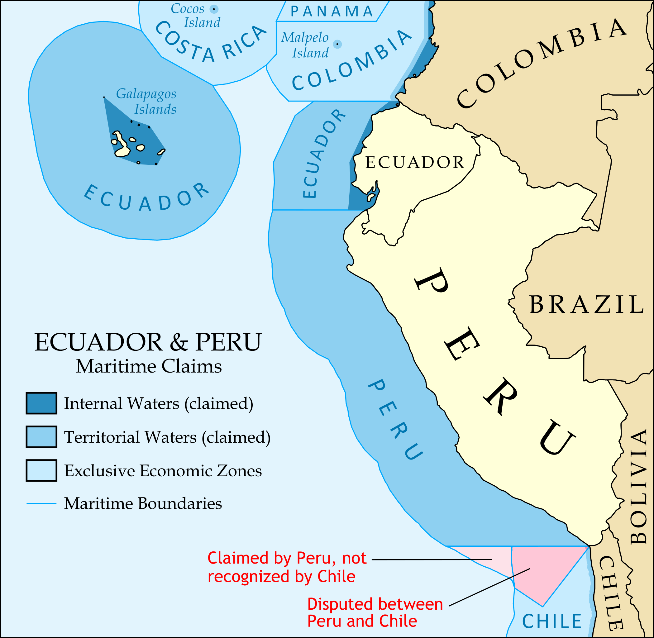
English: Map of the maritime claims of Ecuador, Peru, and surrounding countries, including internal/archipelagic waters, territorial waters, exclusive economic zones (EEZ), and disputed areas. |
| Date | |
| Source | Own work. Land borders and coastlines from Natural Earth; maritime boundaries based on VLIZ Maritime Boundaries Database, v.6, with modifications based on DOD Maritime Claims Reference Manual and other sources. |
| Author | GeoEvan |
| Permission (Reusing this file) |
Modified version of file from Political Geography Now blog, re-licensed here to allow for commercial use. Please credit "Political Geography Now" with link to http://www.polgeonow.com. |
| Other versions |
Derivative works of this file: |
Licensing edit
I, the copyright holder of this work, hereby publish it under the following license:
This file is licensed under the Creative Commons Attribution-Share Alike 3.0 Unported license.
- You are free:
- to share – to copy, distribute and transmit the work
- to remix – to adapt the work
- Under the following conditions:
- attribution – You must give appropriate credit, provide a link to the license, and indicate if changes were made. You may do so in any reasonable manner, but not in any way that suggests the licensor endorses you or your use.
- share alike – If you remix, transform, or build upon the material, you must distribute your contributions under the same or compatible license as the original.
File history
Click on a date/time to view the file as it appeared at that time.
| Date/Time | Thumbnail | Dimensions | User | Comment | |
|---|---|---|---|---|---|
| current | 08:45, 22 January 2012 | | 1,864 × 1,819 (660 KB) | GeoEvan (talk | contribs) | This version might have slightly better pixel alignment (less blur on legend box edges). |
| 15:48, 21 September 2011 |  | 1,864 × 1,819 (660 KB) | GeoEvan (talk | contribs) | Converted text to paths for fonts to display properly (sorry; I designed it this way for another project, and the correct fonts are important) | |
| 15:36, 21 September 2011 |  | 1,864 × 1,819 (307 KB) | GeoEvan (talk | contribs) | Fixed a major formatting problem | |
| 15:22, 21 September 2011 |  | 1,052 × 744 (307 KB) | GeoEvan (talk | contribs) |
You cannot overwrite this file.
File usage on Commons
There are no pages that use this file.
File usage on other wikis
The following other wikis use this file:
- Usage on el.wikipedia.org
- Usage on en.wikipedia.org
- Usage on ja.wikipedia.org