File:Marker at the start of the Bethesda Trolley Trail MD 20201123 123907 1 crop.jpg
Size of this preview: 598 × 600 pixels. Other resolutions: 239 × 240 pixels | 478 × 480 pixels | 765 × 768 pixels | 1,021 × 1,024 pixels | 2,041 × 2,048 pixels | 4,857 × 4,873 pixels.
Original file (4,857 × 4,873 pixels, file size: 16.49 MB, MIME type: image/jpeg)
Captions
Captions
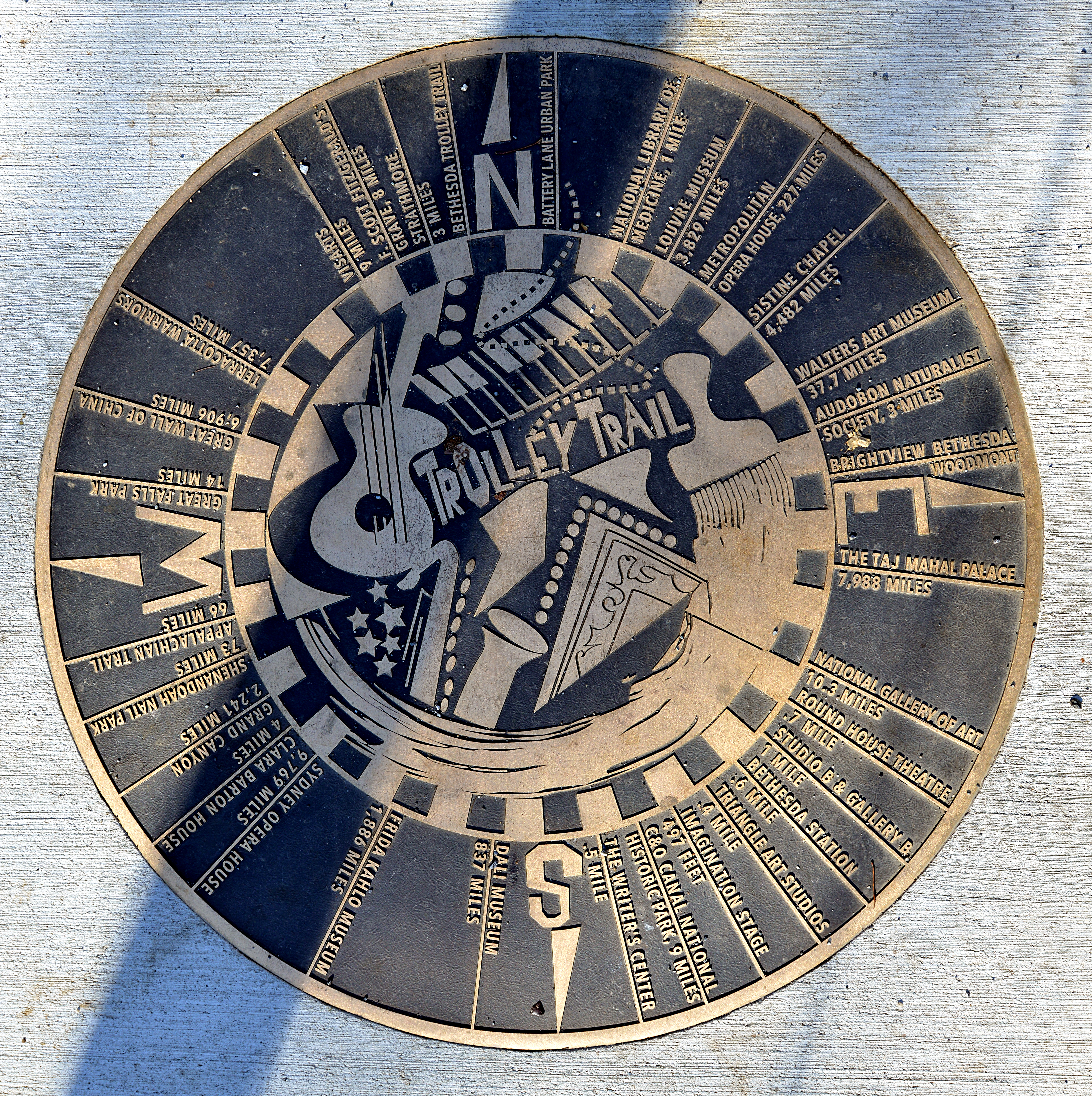
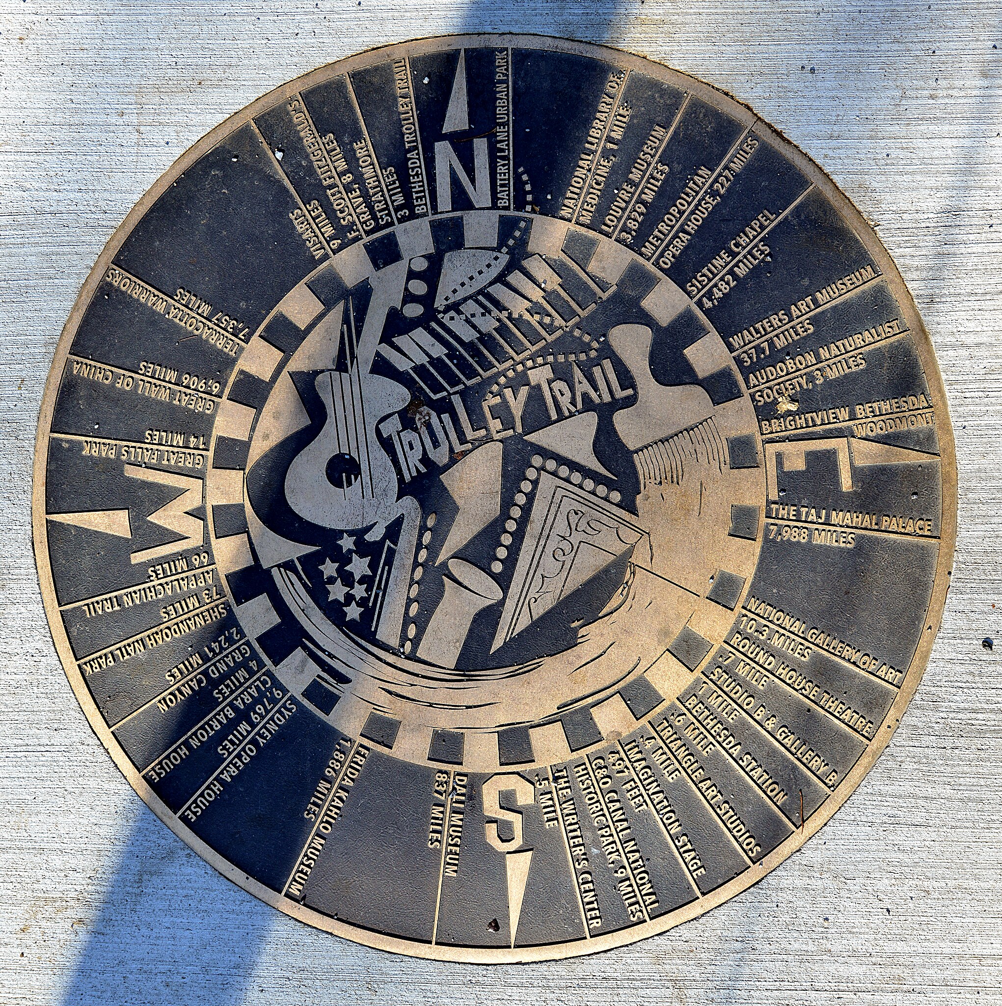
Marker at the start of the Bethesda Trolley Trail
Summary
edit
| Description |
English: This marker is embedded in the sidewalk at the start of the Bethesda Trolley Trail at Battery Lane Park in downtown Bethesda, Maryland. It shows directions and distances to various places, the closest being Imagination Stage (497 feet from the marker) and the furthest being the Sydney Opera House (9,769 miles from the marker). |
| Date | |
| Source | Own work |
| Author | G. Edward Johnson |
| Camera location | | View this and other nearby images on: OpenStreetMap |
|---|
Taken on 23 November 2020, 12:39
This photo was taken with Nikon D800
Battery Lane Park, Bethesda, MD
Licensing
edit
I, the copyright holder of this work, hereby publish it under the following license:
This file is licensed under the Creative Commons Attribution 4.0 International license.
- You are free:
- to share – to copy, distribute and transmit the work
- to remix – to adapt the work
- Under the following conditions:
- attribution – You must give appropriate credit, provide a link to the license, and indicate if changes were made. You may do so in any reasonable manner, but not in any way that suggests the licensor endorses you or your use.
File history
Click on a date/time to view the file as it appeared at that time.
| Date/Time | Thumbnail | Dimensions | User | Comment | |
|---|---|---|---|---|---|
| current | 03:52, 8 December 2020 | | 4,857 × 4,873 (16.49 MB) | Lorax (talk | contribs) | Uploaded own work with UploadWizard |
You cannot overwrite this file.
File usage on Commons
There are no pages that use this file.
File usage on other wikis
The following other wikis use this file:
- Usage on en.wikipedia.org