File:Markwardstiege, Hietzing.jpg

Size of this preview: 420 × 599 pixels. Other resolutions: 168 × 240 pixels | 336 × 480 pixels | 538 × 768 pixels | 718 × 1,024 pixels | 1,436 × 2,048 pixels | 3,264 × 4,656 pixels.
Original file (3,264 × 4,656 pixels, file size: 9.08 MB, MIME type: image/jpeg)
Captions
Captions
Add a one-line explanation of what this file represents
Summary edit
| Description |
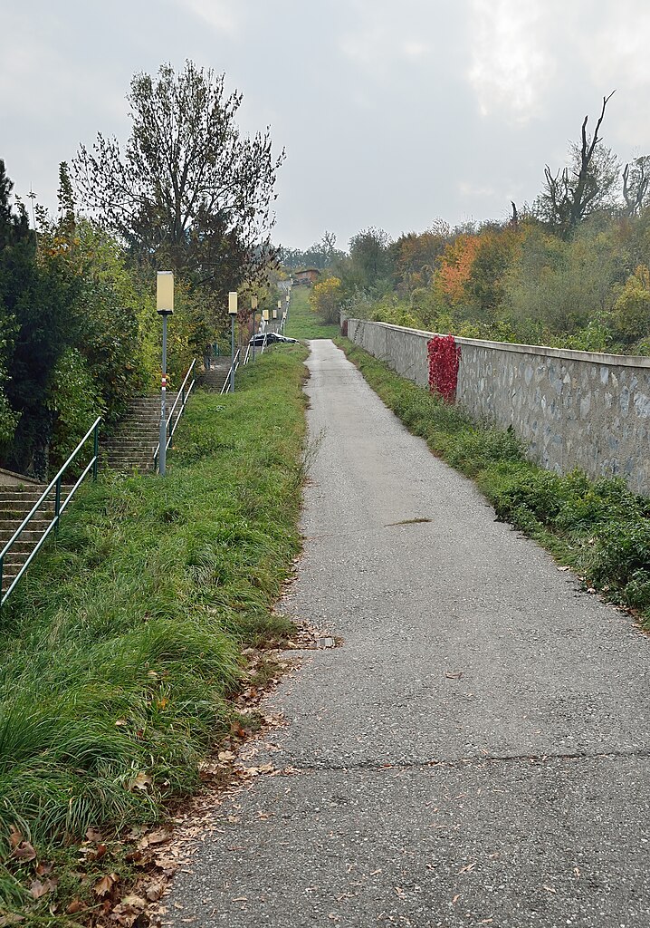
Deutsch: Links die Markwardstiege, die auf einer Länge von 195 m auf 419 Stufen 65 Höhenmeter überwindet. Rechts eine Straße, entsprechender Steigung. Bis zur Hälfte wird sie von einer entsprechend steilen Straße begleitet. Ganz rechts die Mauer des Lainzer Tiergartens. |
| Date | |
| Source | Own work |
| Author | Herzi Pinki |
| Object location | | View this and other nearby images on: OpenStreetMap |
|---|
Licensing edit
I, the copyright holder of this work, hereby publish it under the following license:
This file is licensed under the Creative Commons Attribution-Share Alike 4.0 International license.
- You are free:
- to share – to copy, distribute and transmit the work
- to remix – to adapt the work
- Under the following conditions:
- attribution – You must give appropriate credit, provide a link to the license, and indicate if changes were made. You may do so in any reasonable manner, but not in any way that suggests the licensor endorses you or your use.
- share alike – If you remix, transform, or build upon the material, you must distribute your contributions under the same or compatible license as the original.
File history
Click on a date/time to view the file as it appeared at that time.
| Date/Time | Thumbnail | Dimensions | User | Comment | |
|---|---|---|---|---|---|
| current | 22:31, 23 October 2018 | | 3,264 × 4,656 (9.08 MB) | Herzi Pinki (talk | contribs) | User created page with UploadWizard |
You cannot overwrite this file.
File usage on Commons
There are no pages that use this file.