File:Mars Atlas by Giovanni Schiaparelli 1888.jpg

Size of this preview: 800 × 543 pixels. Other resolutions: 320 × 217 pixels | 640 × 434 pixels | 1,024 × 695 pixels | 1,280 × 868 pixels | 2,000 × 1,357 pixels.
Original file (2,000 × 1,357 pixels, file size: 1.27 MB, MIME type: image/jpeg)
Captions
Captions
Add a one-line explanation of what this file represents
| Description |
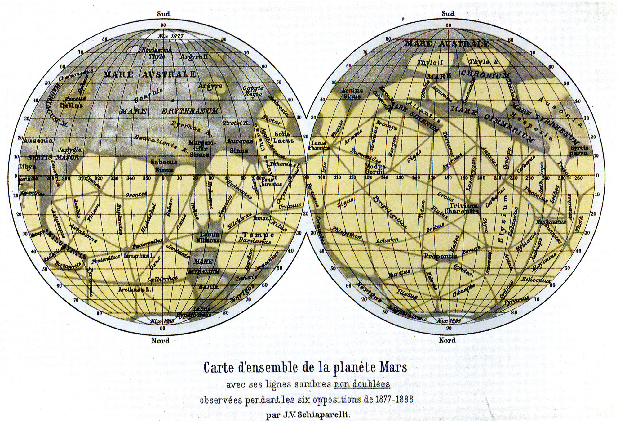
Ελληνικά: Χάρτης του Άρη σχεδιασμένος από τον ιταλό αστρονόμο Τζιοβάννι Σκιαπαρέλλι. Ο χάρτης είναι αντεστραμμένος σε σχέση με τα καθιερωμένα, δηλαδή ο Νότιος Πόλος είναι στην κορυφή.
English: Atlas of Mars by Giovanni Schiaparelli, made in 1888. Note that this is a South-Up map; the South Pole is on top. |
||||||||||||||||||||
| Date | |||||||||||||||||||||
| Source | IPCD,file. | ||||||||||||||||||||
| Author |
|
||||||||||||||||||||
| Permission (Reusing this file) |
|
||||||||||||||||||||

File history
Click on a date/time to view the file as it appeared at that time.
| Date/Time | Thumbnail | Dimensions | User | Comment | |
|---|---|---|---|---|---|
| current | 21:01, 22 September 2011 | | 2,000 × 1,357 (1.27 MB) | Badseed (talk | contribs) | {{Information |Description={{el|Χάρτης του Άρη σχεδιασμένος από τον ιταλό αστρονόμο Τζιοβάννι Σκιαπαρέλλι. Ο χάρτης είναι αντε� |
You cannot overwrite this file.
File usage on Commons
The following page uses this file:
File usage on other wikis
The following other wikis use this file:
- Usage on ga.wikipedia.org
- Usage on ru.wikipedia.org