File:Martinique 1745.jpg
Size of this preview: 800 × 577 pixels. Other resolutions: 320 × 231 pixels | 640 × 462 pixels | 1,024 × 739 pixels | 1,280 × 924 pixels | 2,000 × 1,443 pixels.
Original file (2,000 × 1,443 pixels, file size: 2.57 MB, MIME type: image/jpeg)
Captions
Captions
Add a one-line explanation of what this file represents
Summary
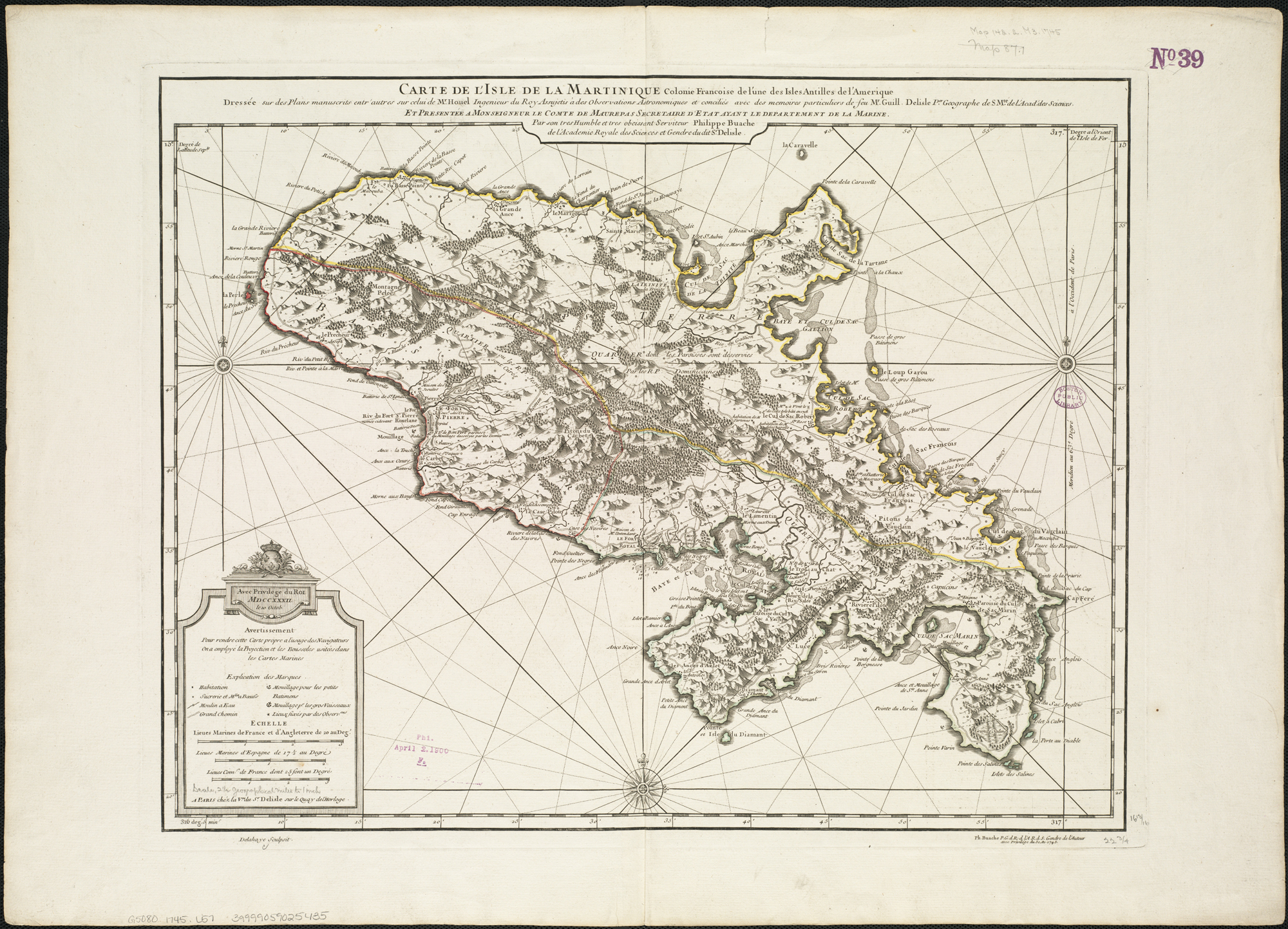
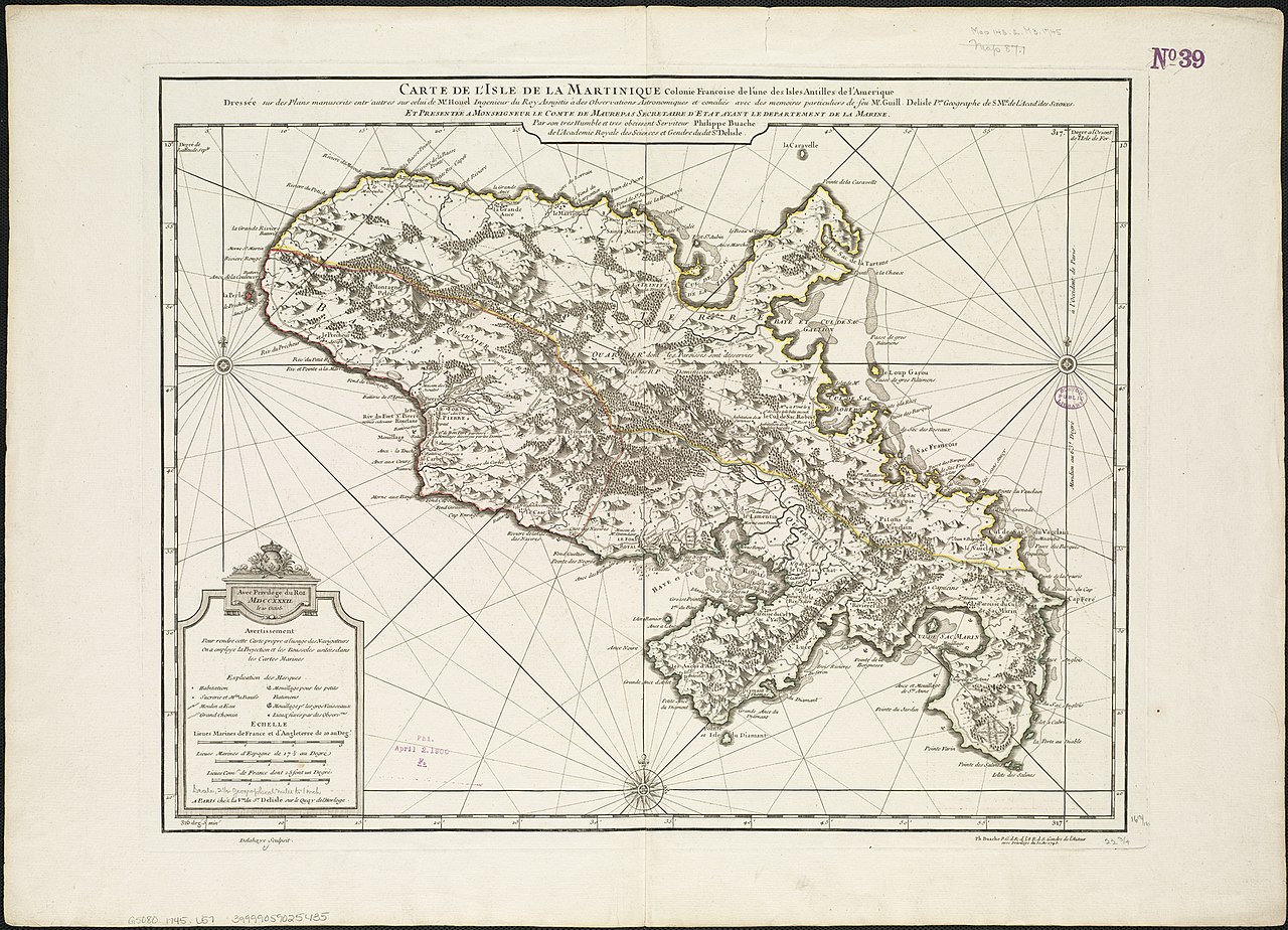
edit| Description |
Zoom into this map at maps.bpl.org. |
|||||||||||||||||||||||
| Date | (uploaded: 2010-05-05 16:06) | |||||||||||||||||||||||
| Source |
|
|||||||||||||||||||||||
| Author | http://maps.bpl.org | |||||||||||||||||||||||

Licensing
edit
|
This is a faithful photographic reproduction of a two-dimensional, public domain work of art. The work of art itself is in the public domain for the following reason:
The official position taken by the Wikimedia Foundation is that "faithful reproductions of two-dimensional public domain works of art are public domain".
This photographic reproduction is therefore also considered to be in the public domain in the United States. In other jurisdictions, re-use of this content may be restricted; see Reuse of PD-Art photographs for details. | ||||
This file is licensed under the Creative Commons Attribution 2.0 Generic license.
- You are free:
- to share – to copy, distribute and transmit the work
- to remix – to adapt the work
- Under the following conditions:
- attribution – You must give appropriate credit, provide a link to the license, and indicate if changes were made. You may do so in any reasonable manner, but not in any way that suggests the licensor endorses you or your use.
| This image was originally posted to Flickr by Norman B. Leventhal Map Center at the BPL at https://www.flickr.com/photos/24528911@N05/4587176206. It was reviewed on 11 May 2010 by FlickreviewR and was confirmed to be licensed under the terms of the cc-by-2.0. |
File history
Click on a date/time to view the file as it appeared at that time.
| Date/Time | Thumbnail | Dimensions | User | Comment | |
|---|---|---|---|---|---|
| current | 15:04, 11 May 2010 | | 2,000 × 1,443 (2.57 MB) | Dr Brains (talk | contribs) | {{Information |Description=Zoom into [http://maps.bpl.org/id/14259 this map] at [http://maps.bpl.org maps.bpl.org]. Author: L'Isle, Guillaume de Publisher: Buache, Philippe Date: 1745 Location: Martinique Dimension 43x58cm Scale: ca. 1:183,333 Call Numb |
You cannot overwrite this file.
File usage on Commons
The following 2 pages use this file: