File:Marvejols-truc du Midi.jpg

Size of this preview: 800 × 600 pixels. Other resolutions: 320 × 240 pixels | 640 × 480 pixels | 1,024 × 768 pixels | 1,280 × 960 pixels | 2,560 × 1,920 pixels | 4,000 × 3,000 pixels.
Original file (4,000 × 3,000 pixels, file size: 2.57 MB, MIME type: image/jpeg)
Captions
Captions
Add a one-line explanation of what this file represents
Summary edit
| Description |
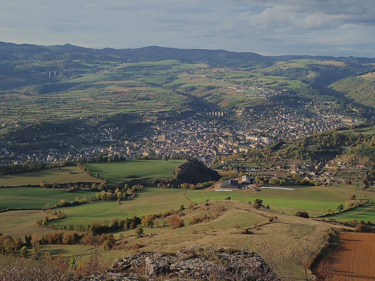
Français : La ville de Marvejols (Lozère) vue du truc du Midi. A l'horizon, à gauche, les premiers sommets de l'Aubrac, en particulier le pic de Mus. On aperçoit également le pont autoroutier du Piou sur l'A75. Plus proche, on peut voir le pont de chemin de fer de Sénouard. Vue remarquable également sur le plateau de Lachamp, plateau calcaire cultivé dont les parcelles sont délimitées par des murs de pierres sèches. A l'extrême droite, on devine le début de la vallée de l'Enfer. |
| Date | |
| Source | Own work |
| Author | Jmp48 |
Licensing edit
I, the copyright holder of this work, hereby publish it under the following license:
This file is licensed under the Creative Commons Attribution-Share Alike 4.0 International license.
- You are free:
- to share – to copy, distribute and transmit the work
- to remix – to adapt the work
- Under the following conditions:
- attribution – You must give appropriate credit, provide a link to the license, and indicate if changes were made. You may do so in any reasonable manner, but not in any way that suggests the licensor endorses you or your use.
- share alike – If you remix, transform, or build upon the material, you must distribute your contributions under the same or compatible license as the original.
| Annotations | This image is annotated: View the annotations at Commons |
File history
Click on a date/time to view the file as it appeared at that time.
| Date/Time | Thumbnail | Dimensions | User | Comment | |
|---|---|---|---|---|---|
| current | 20:57, 19 May 2020 | | 4,000 × 3,000 (2.57 MB) | Jmp48 (talk | contribs) | Uploaded own work with UploadWizard |
You cannot overwrite this file.
File usage on Commons
There are no pages that use this file.
File usage on other wikis
The following other wikis use this file:
- Usage on fr.wikipedia.org