File:May East Bay colored.jpg
Size of this preview: 779 × 600 pixels. Other resolutions: 312 × 240 pixels | 624 × 480 pixels | 865 × 666 pixels.
Original file (865 × 666 pixels, file size: 357 KB, MIME type: image/jpeg)
Captions
Captions
Add a one-line explanation of what this file represents
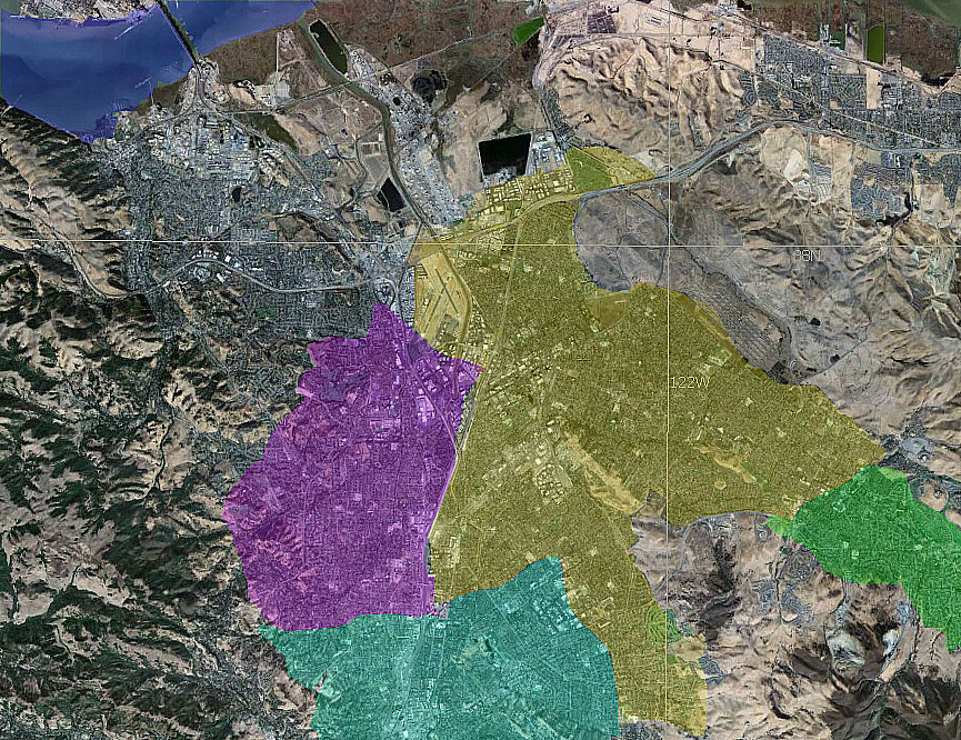
Color-coded are the roughest outlines of the city areas of:
- yellow: Concord
- purple: Pleasant Hill
- green: Clayton and
- turquoise: Walnut Creek
Summary
edit
| Description | Map of the East Bay - color-coded |
| Date | |
| Source | NASA World Wind |
| Author | Boereck 15:27, 23 May 2006 (UTC) |
Licensing
edit
| This image is in the public domain because it is a screenshot from NASA’s globe software World Wind using a public domain layer, such as Blue Marble, MODIS, Landsat, SRTM, USGS or GLOBE.
|
 |
File history
Click on a date/time to view the file as it appeared at that time.
| Date/Time | Thumbnail | Dimensions | User | Comment | |
|---|---|---|---|---|---|
| current | 15:55, 23 May 2006 | | 865 × 666 (357 KB) | Boereck (talk | contribs) | == Summary == {{Information| |Description= Map of the East Bay - color coded |Source= NASA World Wind |Date= 05/23/2006 |Author= Boereck 15:27, 23 May 2006 (UTC) |Permission= see below |other_versions= }} == Licensing == {{PD-WorldWind}} |
You cannot overwrite this file.
File usage on Commons
There are no pages that use this file.