File:Mayotte 76.jpg

Size of this preview: 302 × 598 pixels. Other resolutions: 121 × 240 pixels | 420 × 832 pixels.
Original file (420 × 832 pixels, file size: 71 KB, MIME type: image/jpeg)
Captions
Captions
Add a one-line explanation of what this file represents
Summary edit
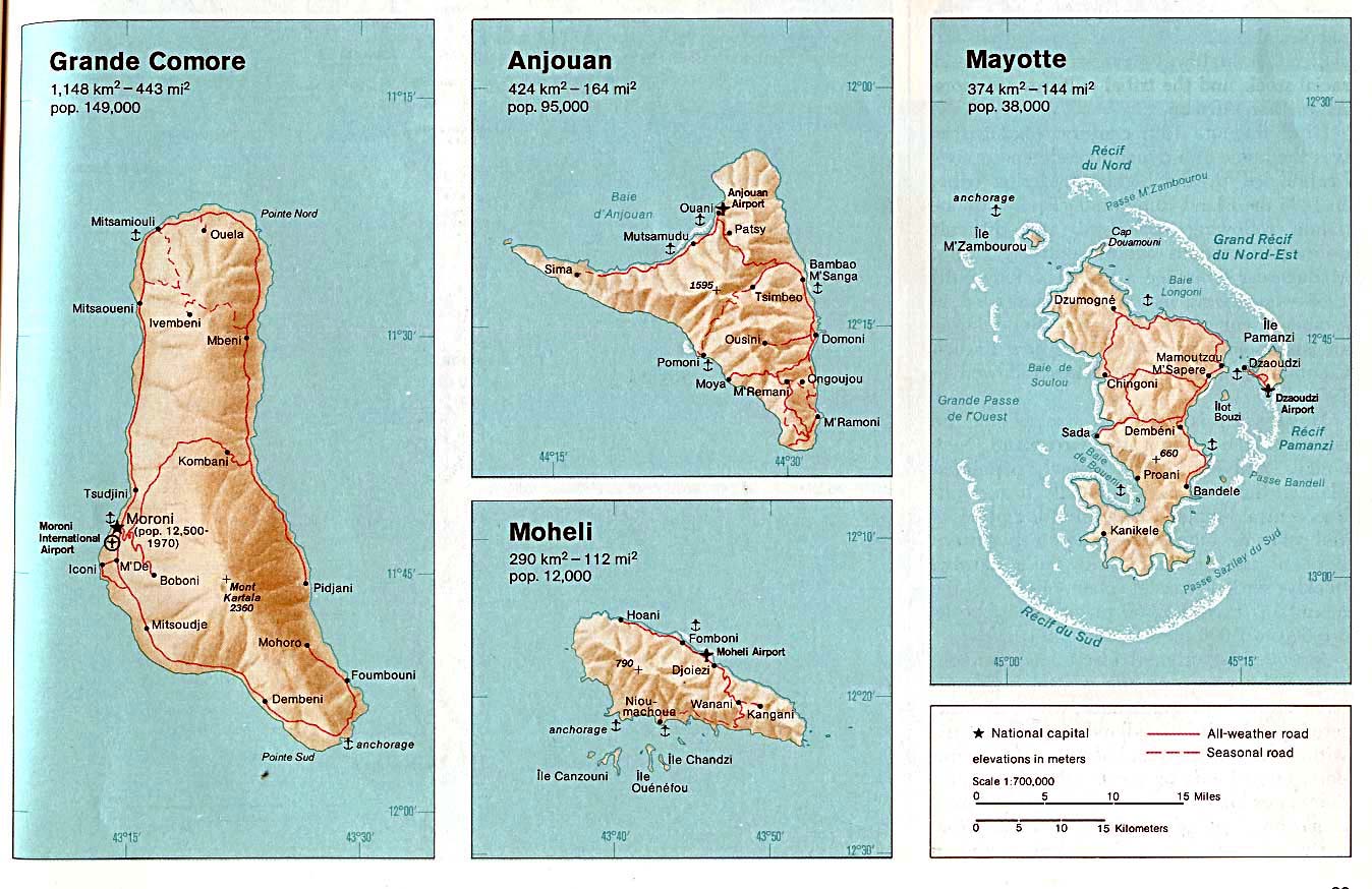
| Description | Mayotte. From The Indian Ocean Atlas, CIA, 1976. |
| Date | |
| Source | University of Texas Libraries, Perry-Castañeda Library Map Collection: Comoros Maps (extracted) |
| Author | CIA |
| Other versions |

Licensing edit
| This image is a work of a Central Intelligence Agency employee, taken or made as part of that person's official duties. As a Work of the United States Government, this image or media is in the public domain in the United States.
|

|
File history
Click on a date/time to view the file as it appeared at that time.
| Date/Time | Thumbnail | Dimensions | User | Comment | |
|---|---|---|---|---|---|
| current | 18:28, 19 December 2009 | | 420 × 832 (71 KB) | Telim tor (talk | contribs) | == {{int:filedesc}} == {{Information |Description= {{en|Map of Mayotte, Indian Ocean}} |Source=http://www.lib.utexas.edu/maps/islands_oceans_poles/comoros_76.jpg |Date=1976 |Author=Taken from Perry-Castañeda Library (PCL), originally from CIA Indian Ocea |
You cannot overwrite this file.
File usage on Commons
The following page uses this file: