File:Meilenblatt B 341 Rosenthal.jpg

Size of this preview: 598 × 599 pixels. Other resolutions: 239 × 240 pixels | 479 × 480 pixels | 766 × 768 pixels | 1,022 × 1,024 pixels | 2,043 × 2,048 pixels | 8,550 × 8,570 pixels.
Original file (8,550 × 8,570 pixels, file size: 21.04 MB, MIME type: image/jpeg)
Captions
Captions
Add a one-line explanation of what this file represents
| Warning | The original file is very high-resolution. It might not load properly or could cause your browser to freeze when opened at full size. |
|---|
Summary
edit
| Title |
[no title] |
| Description |
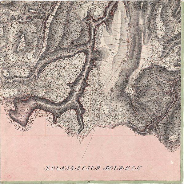
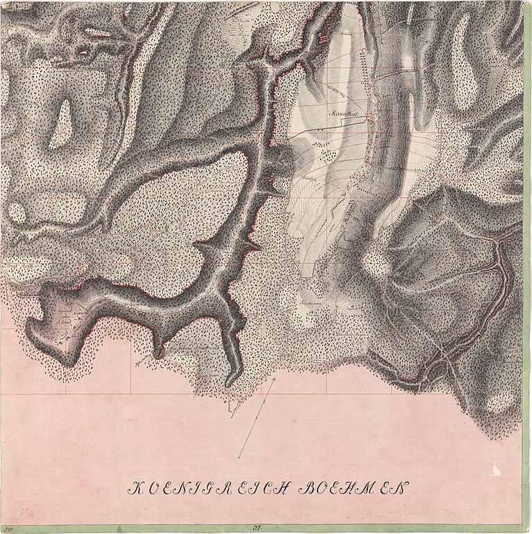
Deutsch: Blatt Nr. 341 aus den Meilenblättern von Sachsen |
| Date | |
| Source | Deutsche Fotothek (id: df_dk_0002341) |
| Creator |
Sächsisches Ingenieur-Korps unter Leitung von Friedrich Ludwig Aster |
| Geotemporal data | |
| Map location | Ostrov, Rosenthal |
| Scale | 1:12,000 |
| Heading |
 |
| Georeferencing | If inappropriate please set warp_status = skip to hide. |
| Bibliographic data | |
| Part of the series | Meilenblätter von Sachsen, Berliner Exemplar |
| Map sheet | 341 |
| Language | German |
| Archival data | |
| Dimensions | height: 57 cm (22.4 in); width: 57 cm (22.4 in) |
| Medium | drawing |
Deutsch: benachbarte Meilenblätter (Berliner Exemplar)
English: adjacent map sheets
| 330 Gottleuba | 331 Berggießhübel | 332 Königstein | ||
| 340 Hellendorf | 341 Rosenthal | 342 Papstdorf | ||
| 349 Reinhardtsdorf |
Licensing
edit
|
This work is in the public domain in its country of origin and other countries and areas where the copyright term is the author's life plus 100 years or fewer. This work is in the public domain in the United States because it was published (or registered with the U.S. Copyright Office) before January 1, 1929. | |
| This file has been identified as being free of known restrictions under copyright law, including all related and neighboring rights. | |
| Annotations | This image is annotated: View the annotations at Commons |
File history
Click on a date/time to view the file as it appeared at that time.
| Date/Time | Thumbnail | Dimensions | User | Comment | |
|---|---|---|---|---|---|
| current | 17:33, 7 January 2021 | | 8,550 × 8,570 (21.04 MB) | Mapmarks (talk | contribs) | {{LargeImage}} == {{int:filedesc}} == {{map |title=[no title] |description={{de|1=Blatt Nr. 341 aus den Meilenblättern von Sachsen}} |author=Sächsisches Ingenieur-Korps unter Leitung von Friedrich Ludwig Aster |date=1782 |source=Deutsche Fotothek (id: df_dk_0002341) |location=Ostrov, Rosenthal |scale=12000 |heading=315 |latitude= |longitude= |warp_status= |warp url= |set=Meilenblätter von Sachsen, Berliner Exemplar |sheet=341 |language=de |publisher= |dimensions={{size|cm|width=57|height=57}... |
You cannot overwrite this file.
File usage on Commons
The following 2 pages use this file:
File usage on other wikis
The following other wikis use this file:
- Usage on de.wikipedia.org