File:Mexico Colima location map (urban areas).svg

Size of this PNG preview of this SVG file: 512 × 389 pixels. Other resolutions: 316 × 240 pixels | 632 × 480 pixels | 1,011 × 768 pixels | 1,280 × 973 pixels | 2,560 × 1,945 pixels.
Original file (SVG file, nominally 512 × 389 pixels, file size: 781 KB)
Captions
Captions
Add a one-line explanation of what this file represents
Summary edit
.svg&action=edit§ion=1)
| Description |
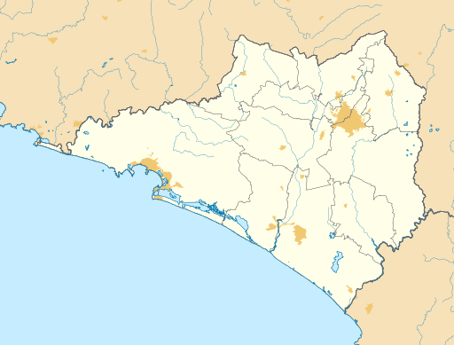
English: Location map of Colima with the urban areas.
EPSG:3857 projection, Geographic limits of the map:
|
| Date | |
| Source |
|
| Author | Addicted04 |
Licensing edit
.svg&action=edit§ion=2)
I, the copyright holder of this work, hereby publish it under the following license:
This file is licensed under the Creative Commons Attribution-Share Alike 4.0 International license.
- You are free:
- to share – to copy, distribute and transmit the work
- to remix – to adapt the work
- Under the following conditions:
- attribution – You must give appropriate credit, provide a link to the license, and indicate if changes were made. You may do so in any reasonable manner, but not in any way that suggests the licensor endorses you or your use.
- share alike – If you remix, transform, or build upon the material, you must distribute your contributions under the same or compatible license as the original.
File history
Click on a date/time to view the file as it appeared at that time.
| Date/Time | Thumbnail | Dimensions | User | Comment | |
|---|---|---|---|---|---|
| current | 14:44, 5 June 2016 | | 512 × 389 (781 KB) | Addicted04 (talk | contribs) | States borders |
| 14:40, 5 June 2016 |  | 512 × 389 (781 KB) | Addicted04 (talk | contribs) | Bordes | |
| 13:49, 5 June 2016 |  | 512 × 389 (782 KB) | Addicted04 (talk | contribs) | User created page with UploadWizard |
You cannot overwrite this file.
File usage on Commons
There are no pages that use this file.
File usage on other wikis
The following other wikis use this file:
- Usage on en.wikipedia.org
- Usage on es.wikipedia.org
- Colima (Colima)
- Manzanillo
- Ciudad de Armería
- Comala
- Anexo:Patrimonio de la Humanidad en México
- Minatitlán (Colima)
- Coquimatlán
- Aeropuerto Internacional de Manzanillo
- Suchitlán
- Villa de Álvarez
- Tecomán
- Aeropuerto Nacional Licenciado Miguel de la Madrid
- Pueblo Juárez
- Chandiablo
- Cuauhtémoc (Colima)
- El Chavarín (Colima)
- Camotlán de Miraflores
- La Yerbabuena (Colima)
- Madrid (Colima)
- Montitlán
- La Central (Colima)
- Plantilla:Mapa de localización de Colima
- Los Tepames
- Ixtlahuacán (Colima)
- Anexo:Pueblos mágicos
- Boca de Pascuales
- Cofradía de Suchitlán
- Quesería (Colima)
- Cofradía de Juárez
- Cerro de Ortega
- El Colomo
- Usage on ja.wikipedia.org
- Usage on si.wikipedia.org
.svg&oldid=505933190)