File:Microrregiões do RN.png
Size of this preview: 800 × 497 pixels. Other resolutions: 320 × 199 pixels | 640 × 397 pixels | 1,024 × 636 pixels | 1,280 × 795 pixels | 2,000 × 1,242 pixels.
Original file (2,000 × 1,242 pixels, file size: 423 KB, MIME type: image/png)
Captions
Captions
Add a one-line explanation of what this file represents

|
File:RioGrandedoNorte Microregions.svg is a vector version of this file. It should be used in place of this PNG file when not inferior.
File:Microrregiões do RN.png → File:RioGrandedoNorte Microregions.svg
For more information, see Help:SVG. |
 |

|
Standardization of derivative maps
Feel free to create derivations of this work, but if you want to illustrate a Wikipedia article with derivative works of this or similar maps of Brazil, please strictly follow the visual standard, nomenclature and classification already in use. All maps of Brazilian subdivisions are being adaptated or created in this way. We do not want to inhibit creativity but the pattern adopted here was presented and accepted by the Lusophone community and should be followed whenever possible. |
| Description |
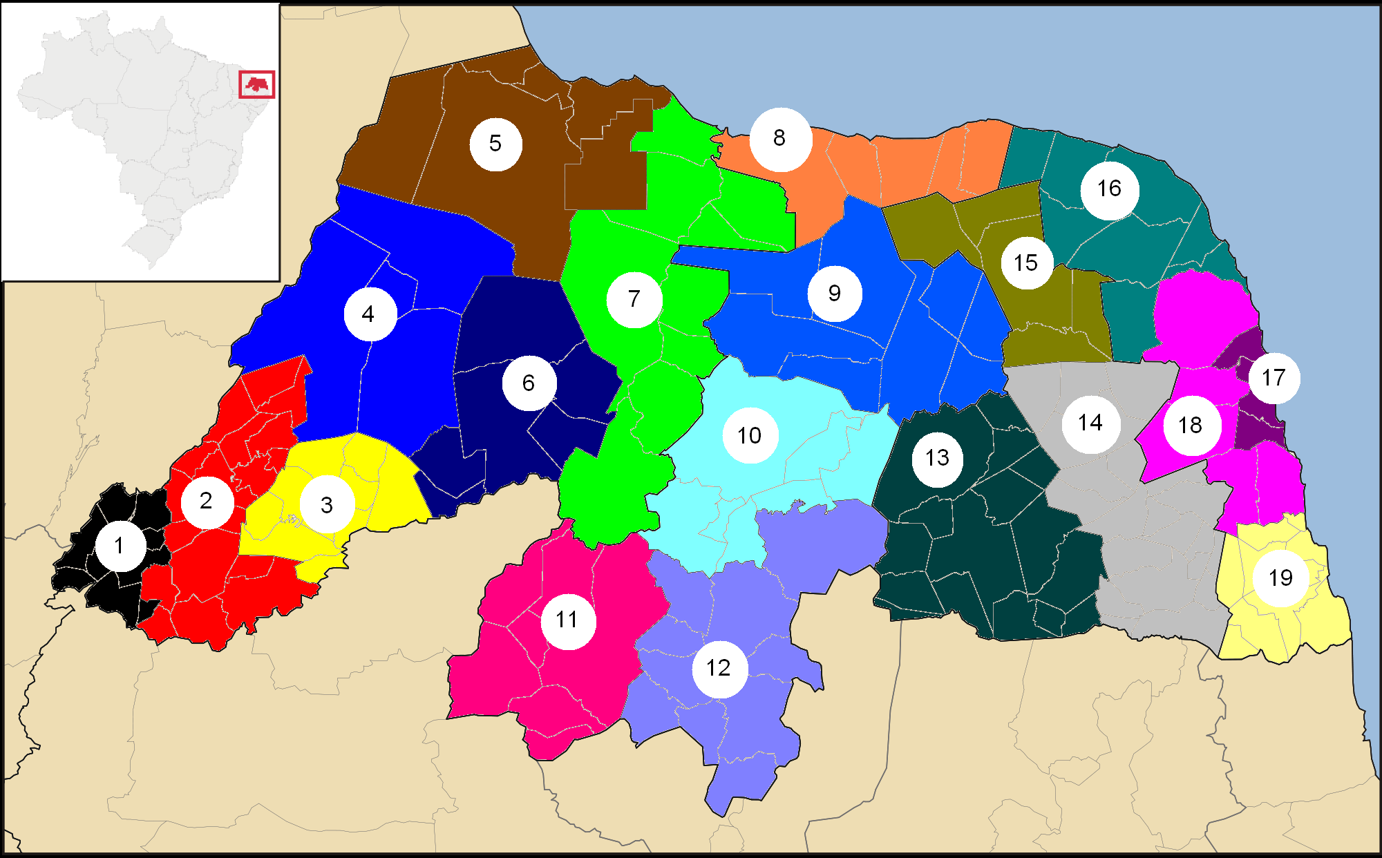
English: Map of Bahia's microregions.
Português: Mapa das microrregiões do Rio Grande do Norte
|
||||||||
| Date | |||||||||
| Source | File:RioGrandedoNorte MesoMicroMunicip.svg by Raphael Lorenzeto de Abreu | ||||||||
| Author | Upload by Marcos Elias de Oliveira Júnior | ||||||||
| Permission (Reusing this file) |
I, the copyright holder of this work, hereby publish it under the following licenses:
This file is licensed under the Creative Commons Attribution 2.5 Generic license.
You may select the license of your choice. |
||||||||
| Other versions |
 |

File history
Click on a date/time to view the file as it appeared at that time.
| Date/Time | Thumbnail | Dimensions | User | Comment | |
|---|---|---|---|---|---|
| current | 17:15, 28 May 2011 | | 2,000 × 1,242 (423 KB) | Marquinhos (talk | contribs) | Correction: Fernando Pedroza in Angicos's microrregion, not Serra de Santana. |
| 16:37, 28 May 2011 |  | 2,000 × 1,242 (395 KB) | Marquinhos (talk | contribs) | {{Information |Description ={{en|1=Map of Bahia's microregions.}} {{pt|1=Mapa das microrregiões do Rio Grande do Norte}} |Source =File:RioGrandedoNorte MesoMicroMunicip.svg by Raphael Lorenzeto de Abreu |Author |
You cannot overwrite this file.
File usage on Commons
There are no pages that use this file.