File:Middleton Railway Blue Plaque (7906790148).jpg
Size of this preview: 800 × 600 pixels. Other resolutions: 320 × 240 pixels | 640 × 480 pixels | 1,024 × 768 pixels | 1,280 × 960 pixels | 2,560 × 1,920 pixels.
Original file (2,560 × 1,920 pixels, file size: 836 KB, MIME type: image/jpeg)
Captions
Captions
Add a one-line explanation of what this file represents
Summary
edit.jpg&action=edit§ion=1)
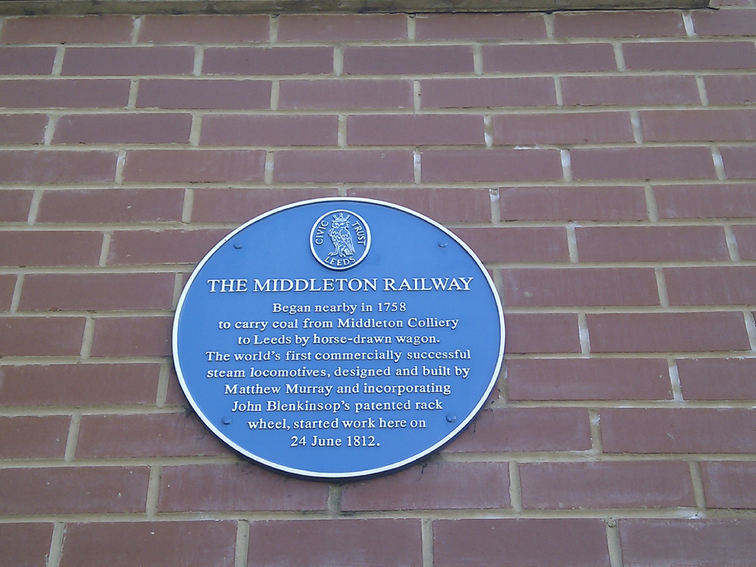
| Description | The Middleton Railway Began nearby in 1758 to carry coal from Middleton Colliery to Leeds by horse-drawn wagon. The world's first commercially successful steam locomotives, designed and built by Matthew Murray and incorporating John Blenkinsop's patented rack wheel, started work here on 24 June 1812. |
| Date | |
| Source | 10pts |
| Author | ben dalton from leeds, uk |
| Camera location | | View this and other nearby images on: OpenStreetMap |
|---|
.jpg¶ms=053.774755_N_-001.538295_E_globe:Earth_type:camera_source:Flickr_&language=en)
Licensing
edit.jpg&action=edit§ion=2)
This file is licensed under the Creative Commons Attribution 2.0 Generic license.
- You are free:
- to share – to copy, distribute and transmit the work
- to remix – to adapt the work
- Under the following conditions:
- attribution – You must give appropriate credit, provide a link to the license, and indicate if changes were made. You may do so in any reasonable manner, but not in any way that suggests the licensor endorses you or your use.
| This image was originally posted to Flickr by noii's at https://flickr.com/photos/17306001@N00/7906790148 (archive). It was reviewed on 1 October 2019 by FlickreviewR 2 and was confirmed to be licensed under the terms of the cc-by-2.0. |
File history
Click on a date/time to view the file as it appeared at that time.
| Date/Time | Thumbnail | Dimensions | User | Comment | |
|---|---|---|---|---|---|
| current | 18:22, 1 October 2019 | | 2,560 × 1,920 (836 KB) | Sic19 (talk | contribs) | Transferred from Flickr via #flickr2commons |
You cannot overwrite this file.
File usage on Commons
The following 2 pages use this file:
File usage on other wikis
The following other wikis use this file:
- Usage on en.wikipedia.org
- Usage on www.wikidata.org
.jpg&oldid=898213351)