File:Milano - mappa rete metropolitana (geografica +sfondo) - 2013-02-10.svg

Size of this PNG preview of this SVG file: 800 × 492 pixels. Other resolutions: 320 × 197 pixels | 640 × 394 pixels | 1,024 × 630 pixels | 1,280 × 788 pixels | 2,560 × 1,576 pixels | 2,029 × 1,249 pixels.
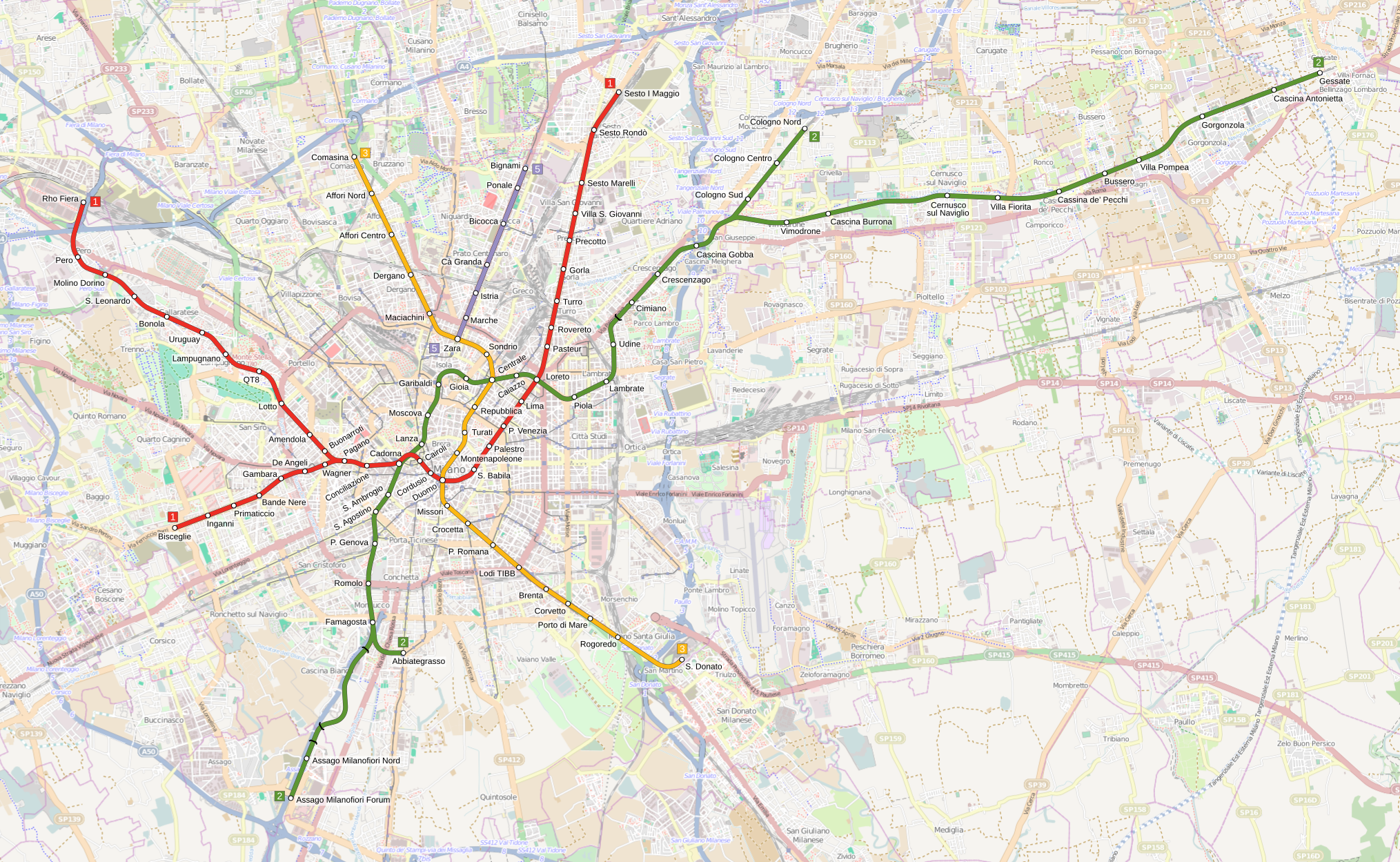
Original file (SVG file, nominally 2,029 × 1,249 pixels, file size: 7.8 MB)
Captions
Captions
Add a one-line explanation of what this file represents
Summary
edit_-_2013-02-10.svg&action=edit§ion=1)
| Description |
Italiano: Mappa della metropolitana di Milano dopo l'estensione del 10 febbraio 2013. |
| Source | Own work. Background map form Openstreetmap (http://www.openstreetmap.org/). |
| Author | Arbalete |
| Permission (Reusing this file) |
I, the copyright holder of this work, hereby publish it under the following license: This file is licensed under the Creative Commons Attribution-Share Alike 3.0 Unported license.
|
File history
Click on a date/time to view the file as it appeared at that time.
| Date/Time | Thumbnail | Dimensions | User | Comment | |
|---|---|---|---|---|---|
| current | 12:28, 12 February 2014 | | 2,029 × 1,249 (7.8 MB) | Arbalete (talk | contribs) | User created page with UploadWizard |
You cannot overwrite this file.
File usage on Commons
The following page uses this file:
- File:Milano mappa rete metropolitana 2013-02-10.svg (file redirect)
_-_2013-02-10.svg&oldid=499263154)