File:Milano mappa M1 2005-12-19.svg

Size of this PNG preview of this SVG file: 754 × 600 pixels. Other resolutions: 302 × 240 pixels | 603 × 480 pixels | 965 × 768 pixels | 1,280 × 1,018 pixels | 2,560 × 2,037 pixels | 1,174 × 934 pixels.
Original file (SVG file, nominally 1,174 × 934 pixels, file size: 8.05 MB)
Captions
Captions
Add a one-line explanation of what this file represents
Summary edit
| Description |
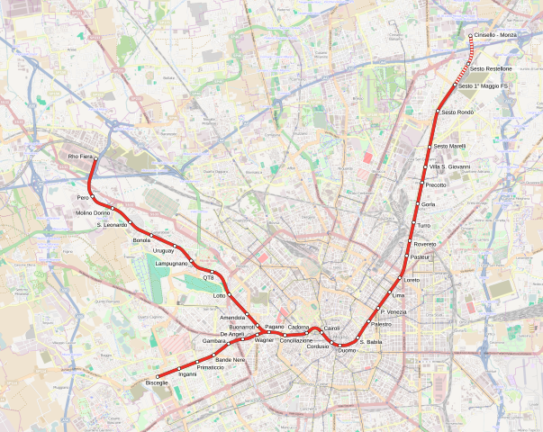
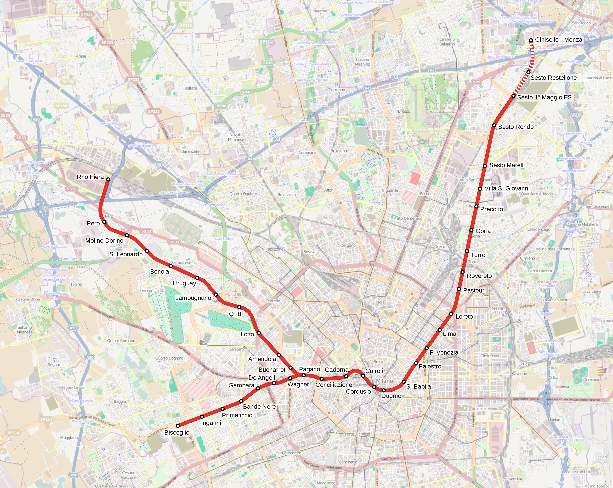
Italiano: Mappa della linea M1 della metropolitana di Milano dopo l'estensione del 19 dicembre 2005. |
| Source | Own work. Background map form Openstreetmap (http://www.openstreetmap.org/). |
| Author | Arbalete |
| Permission (Reusing this file) |
I, the copyright holder of this work, hereby publish it under the following license: This file is licensed under the Creative Commons Attribution-Share Alike 3.0 Unported license.
|
File history
Click on a date/time to view the file as it appeared at that time.
| Date/Time | Thumbnail | Dimensions | User | Comment | |
|---|---|---|---|---|---|
| current | 19:48, 2 May 2021 | | 1,174 × 934 (8.05 MB) | Emanuele Lorenzo Corti (talk | contribs) | Correzione del caricamento precedente. |
| 14:14, 30 April 2021 |  | 1,174 × 934 (8.03 MB) | Emanuele Lorenzo Corti (talk | contribs) | Aggiunta tratta in costruzione per Cinisello - Monza; aggiornato capolinea "Sesto 1° Maggio FS". | |
| 10:40, 28 February 2014 |  | 1,174 × 934 (8.04 MB) | Arbalete (talk | contribs) | User created page with UploadWizard |
You cannot overwrite this file.
File usage on Commons
The following 5 pages use this file:
File usage on other wikis
The following other wikis use this file:
- Usage on el.wikipedia.org
- Usage on en.wikipedia.org
- Usage on fr.wikipedia.org
- Usage on hu.wikipedia.org
- Usage on it.wikipedia.org
- Usage on ja.wikipedia.org
- Usage on ko.wikipedia.org
- Usage on lmo.wikipedia.org
- Usage on nl.wikipedia.org
- Usage on oc.wikipedia.org
- Usage on ru.wikipedia.org
- Usage on www.wikidata.org