File:MilitaryMapBudjak1800.jpg

Original file (3,367 × 8,314 pixels, file size: 7.78 MB, MIME type: image/jpeg)
Captions
Captions
Summary
edit
| Description |
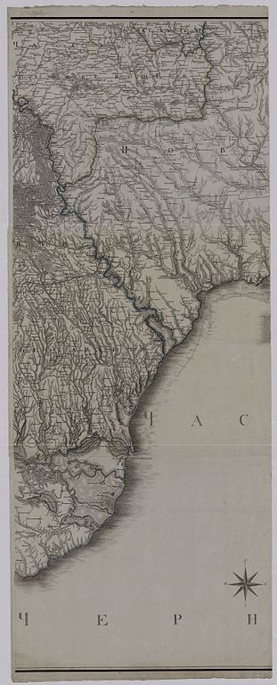
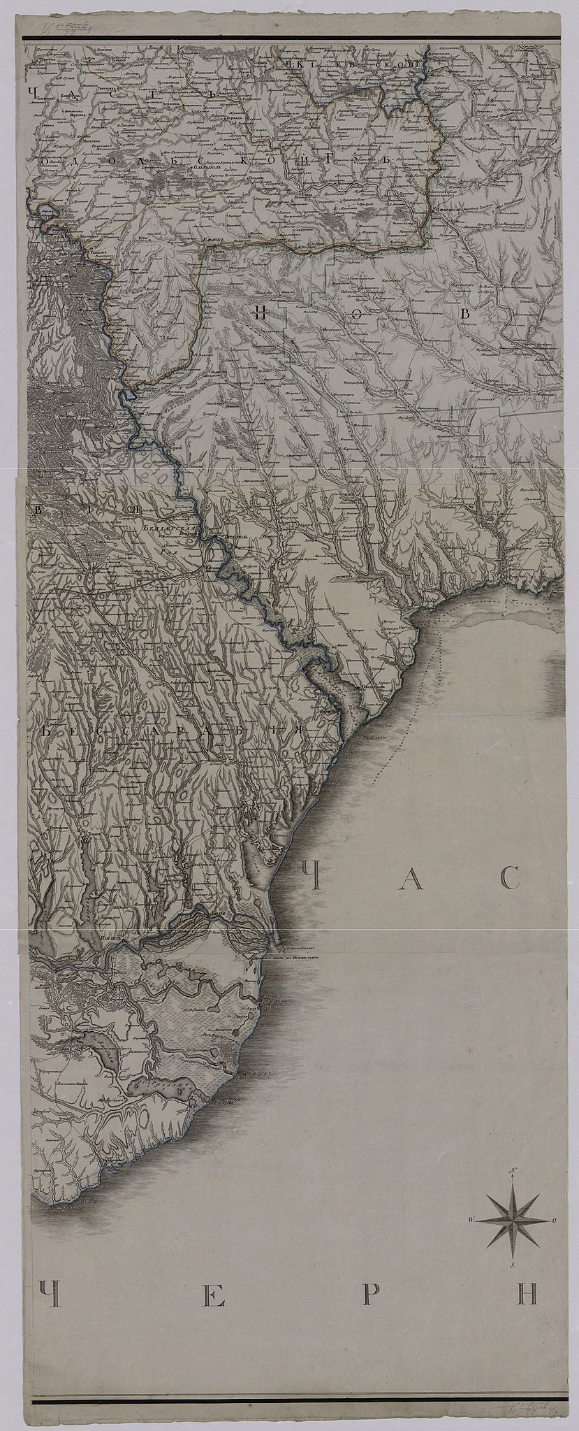
Українська: Військова карта по кордону Російської імперії з Польщою 1800 року Повна назва: "Подробная милитерная карта по границе России с Турцией. Соч. и грав. при собств. Е. И. В. Депо карт. Часть I. - [Санкт-Петербург]: 1800." |
| Date | |
| Source | http://kraeved.od.ua/ |
| Author | Соч. и грав. при собств. Е. И. В. Депо карт. |
Licensing
edit
|
This is a faithful photographic reproduction of a two-dimensional, public domain work of art. The work of art itself is in the public domain for the following reason:
The official position taken by the Wikimedia Foundation is that "faithful reproductions of two-dimensional public domain works of art are public domain". This photographic reproduction is therefore also considered to be in the public domain in the United States. In other jurisdictions, re-use of this content may be restricted; see Reuse of PD-Art photographs for details. {{PD-Art}} template without license parameter: please specify why the underlying work is public domain in both the source country and the United States
(Usage: {{PD-Art|1=|deathyear=''year of author's death''|country=''source country''}}, where parameter 1= can be PD-old-auto, PD-old-auto-expired, PD-old-auto-1996, PD-old-100 or similar. See Commons:Multi-license copyright tags for more information.) | ||||
File history
Click on a date/time to view the file as it appeared at that time.
| Date/Time | Thumbnail | Dimensions | User | Comment | |
|---|---|---|---|---|---|
| current | 22:05, 3 July 2016 | 3,367 × 8,314 (7.78 MB) | Roman.alieiev (talk | contribs) | User created page with UploadWizard |
You cannot overwrite this file.
File usage on Commons
There are no pages that use this file.
File usage on other wikis
The following other wikis use this file:
- Usage on uk.wikipedia.org