File:Mimizan Cassini.jpg
Size of this preview: 800 × 512 pixels. Other resolutions: 320 × 205 pixels | 640 × 410 pixels | 915 × 586 pixels.
Original file (915 × 586 pixels, file size: 185 KB, MIME type: image/jpeg)
Captions
Captions
Add a one-line explanation of what this file represents
Summary
edit
| Description |
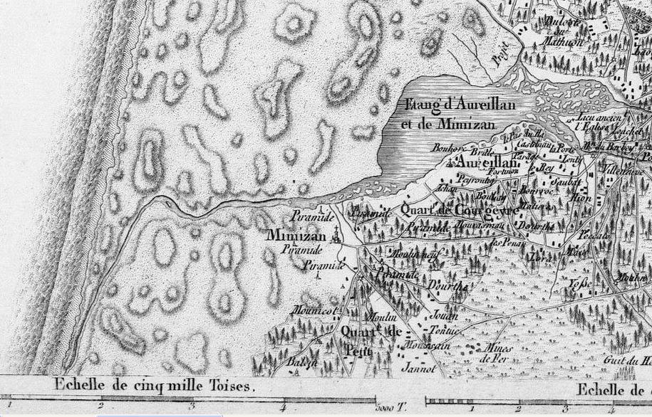
Français : Extrait de la carte de Cassini (feuille n° 137) vers 1780(Sur cette carte, le courant de Mimizan débouche environ 2000 toises au sud de son exutoire actuel,soit environ 3800 m) |
| Date | before 1783 |
| Source | Planche ouvrage Mesurer la Terre. |
| Author | J.J. Levallois |
Licensing
edit
|
This work is in the public domain in its country of origin and other countries and areas where the copyright term is the author's life plus 100 years or fewer. | |
| This file has been identified as being free of known restrictions under copyright law, including all related and neighboring rights. | |
File history
Click on a date/time to view the file as it appeared at that time.
| Date/Time | Thumbnail | Dimensions | User | Comment | |
|---|---|---|---|---|---|
| current | 09:54, 14 January 2020 | | 915 × 586 (185 KB) | Jibi44 (talk | contribs) | User created page with UploadWizard |
You cannot overwrite this file.
File usage on Commons
The following page uses this file:
File usage on other wikis
The following other wikis use this file:
- Usage on fr.wikipedia.org
- Usage on zh.wikipedia.org