File:Minnehaha Falls 1914 USGS.jpg

Size of this preview: 587 × 600 pixels. Other resolutions: 235 × 240 pixels | 470 × 480 pixels | 700 × 715 pixels.
Original file (700 × 715 pixels, file size: 333 KB, MIME type: image/jpeg)
Captions
Captions
Add a one-line explanation of what this file represents
| Description |
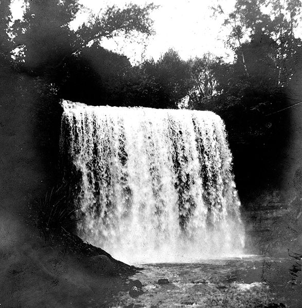
English: Minnehaha Falls, the stream falls 63 feet over Platteville limestone capping St. Peter sandstone Hennepin County, Minnesota. 1914. Plate 8 in U.S. Geological Survey. Folio 201. 1916. (Description from USGS) |
|||
| Date | ||||
| Source | United States Geological Survey Photographic Library; http://libraryphoto.cr.usgs.gov/cgi-bin/show_picture.cgi?ID=ID.%20Sardeson,%20F.W.%2014 | |||
| Author | Sardeson, F.W. | |||
| Permission (Reusing this file) |
|
File history
Click on a date/time to view the file as it appeared at that time.
| Date/Time | Thumbnail | Dimensions | User | Comment | |
|---|---|---|---|---|---|
| current | 00:44, 30 October 2008 | | 700 × 715 (333 KB) | Awickert (talk | contribs) | {{Information |Description={{en|1=Minnehaha Falls, the stream falls 63 feet over Platteville limestone capping St. Peter sandstone Hennepin County, Minnesota. 1914. Plate 8 in U.S. Geological Survey. Folio 201. 1916. (Description from USGS)}} |Source=Unit |
You cannot overwrite this file.
File usage on Commons
There are no pages that use this file.
File usage on other wikis
The following other wikis use this file:
- Usage on en.wikipedia.org
- Usage on fa.wikipedia.org