File:Minsk location map.svg

Size of this PNG preview of this SVG file: 800 × 568 pixels. Other resolutions: 320 × 227 pixels | 640 × 454 pixels | 1,024 × 727 pixels | 1,280 × 909 pixels | 2,560 × 1,817 pixels | 1,110 × 788 pixels.
Original file (SVG file, nominally 1,110 × 788 pixels, file size: 5.83 MB)
Captions
Captions
Add a one-line explanation of what this file represents
Summary
edit
| Description |
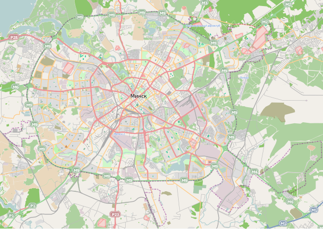
English: Location map of Minsk
Equirectangular projection. Geographic limits of the map:
|
| Date | |
| Source | Own work |
| Author | Чаховіч Уладзіслаў |
Licensing
edit
I, the copyright holder of this work, hereby publish it under the following licenses:
This file is licensed under the Creative Commons Attribution-Share Alike 3.0 Unported license.
- You are free:
- to share – to copy, distribute and transmit the work
- to remix – to adapt the work
- Under the following conditions:
- attribution – You must give appropriate credit, provide a link to the license, and indicate if changes were made. You may do so in any reasonable manner, but not in any way that suggests the licensor endorses you or your use.
- share alike – If you remix, transform, or build upon the material, you must distribute your contributions under the same or compatible license as the original.

|
Permission is granted to copy, distribute and/or modify this document under the terms of the GNU Free Documentation License, Version 1.2 or any later version published by the Free Software Foundation; with no Invariant Sections, no Front-Cover Texts, and no Back-Cover Texts. A copy of the license is included in the section entitled GNU Free Documentation License. |
You may select the license of your choice.
File history
Click on a date/time to view the file as it appeared at that time.
| Date/Time | Thumbnail | Dimensions | User | Comment | |
|---|---|---|---|---|---|
| current | 14:54, 10 December 2012 | | 1,110 × 788 (5.83 MB) | Чаховіч Уладзіслаў (talk | contribs) | обновление |
| 11:29, 12 March 2011 |  | 1,111 × 789 (4.36 MB) | Чаховіч Уладзіслаў (talk | contribs) | {{Information |Description ={{en|1=Location map of Minsk}} Equirectangular projection. Geographic limits of the map: * N: 53.9814° N * S: 53.7941° N * W: 27.37° E * E: 27.8173° E}} |Source ={{own}} |Author =[ |
You cannot overwrite this file.
File usage on Commons
There are no pages that use this file.
File usage on other wikis
The following other wikis use this file:
- Usage on az.wikipedia.org
- Usage on ba.wikipedia.org
- Usage on be.wikipedia.org
- Usage on bg.wikipedia.org
- Usage on de.wikivoyage.org
- Usage on fy.wikipedia.org
- Usage on ja.wikipedia.org
- Usage on kk.wikipedia.org
- Usage on ru.wikipedia.org
- Минский автомобильный завод
- Минский тракторный завод
- Минск-1 (аэропорт)
- Атлант (компания)
- Белорусский государственный университет
- Парк Челюскинцев (Минск)
- Горизонт (предприятие, Белоруссия)
- Дрозды (водохранилище)
- Чижовское водохранилище
- Цнянское водохранилище
- Интеграл (компания)
- Минский троллейбус
- Комсомольское озеро (пруд, Минск)
- Минск Мир
- Минский моторный завод
- Чемпионат мира по хоккею с шайбой 2014
- Минский автобус
- Минский мотоциклетно-велосипедный завод
- Лошица (река)
- Александровский сквер (Минск)
- Севастопольский парк (Минск)
- Парк имени Янки Купалы (Минск)
- Сендайский сквер (Минск)
- Минская ТЭЦ-3
- Городская клиническая больница скорой медицинской помощи (Минск)
- Список больниц Минска
- Мышка (приток Лошицы)
- Парк имени 50-летия Великого Октября (Минск)
- Парк имени 900-летия города Минска
View more global usage of this file.