File:Miradouro do Alto da Serra da Marofa - Portugal (11772429744).jpg

Original file (3,845 × 2,552 pixels, file size: 1.98 MB, MIME type: image/jpeg)
Captions
Captions
Summary edit
.jpg&action=edit§ion=1)
| Description |
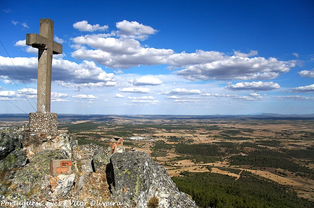
A melhor forma de despedir-nos desta belíssima terra , onde está aldeia de Castelo Rodrigo, ( onde voltaremos brevemente) e a lindíssima vila de Figueira de Castelo Rodrigo é avistá-la ao longe no miradouro natural da Serra da Marofa . “O cimo da Serra da Marofa é um excelente(…) ponto de atracção para o elevado número de visitantes que não perdem a oportunidade de admirar a deslumbrante panorâmica que daqui se avista. A monotonia do verde das hortas, do arvoredo, das vinhas e do mato rasteiro, cruza com o tom dourado das searas e da terra. Ao fundo, no limite do horizonte longínquo que se abarca em redor, na direcção do Nordeste, sobressaem, em tom ligeiramente acinzentado, com cambiantes de laivos azuis claros, as montanhas de Trás-os-Montes, destacando-se as dos Bornes e Montemuro. A Poente, as elevações onde se evidencia a cidade amuralhada de Trancoso, Vila Nova de Foz Côa e a vila de Meda. Para sul, a imponência da Serra da Estrela, a mais alta de Portugal Continental. Ao longe, para Nascente, até onde olhar pode alcançar, avistam-se terras de Espanha, englobando a vastíssima região de Salamanca, desde Saucelhe até às alturas de Bejar e Penha de França. Aqui e além, sobressai o colorido das pequenas povoações, onde o casario branco, coroado de telhados vermelhos, empresta uma coloração garrida e alegre à paisagem natural, humanizando-a”. <a href="http://aldeiashistoricasdeportugal.blogspot.pt/2009/04/o-miradouro-natural-da-marofa.html" rel="nofollow">aldeiashistoricasdeportugal.blogspot.pt/2009/04/o-miradou...</a> <a href="http://loc.alize.us/#/flickr:11772429744" rel="nofollow">See where this picture was taken.</a> <a href="https://www.flickr.com/groups/geotagging/discuss/72157594165549916/">[?]</a> |
| Date | |
| Source | Miradouro do Alto da Serra da Marofa - Portugal |
| Author | Vitor Oliveira from Torres Vedras, PORTUGAL |
| Camera location | | View this and other nearby images on: OpenStreetMap |
|---|
.jpg¶ms=040.863823_N_-006.991419_E_globe:Earth_type:camera_source:Flickr_&language=en)
Licensing edit
.jpg&action=edit§ion=2)
- You are free:
- to share – to copy, distribute and transmit the work
- to remix – to adapt the work
- Under the following conditions:
- attribution – You must give appropriate credit, provide a link to the license, and indicate if changes were made. You may do so in any reasonable manner, but not in any way that suggests the licensor endorses you or your use.
- share alike – If you remix, transform, or build upon the material, you must distribute your contributions under the same or compatible license as the original.
| This image was originally posted to Flickr by Portuguese_eyes at https://flickr.com/photos/21446942@N00/11772429744 (archive). It was reviewed on 28 March 2019 by FlickreviewR 2 and was confirmed to be licensed under the terms of the cc-by-sa-2.0. |
File history
Click on a date/time to view the file as it appeared at that time.
| Date/Time | Thumbnail | Dimensions | User | Comment | |
|---|---|---|---|---|---|
| current | 04:16, 28 March 2019 | | 3,845 × 2,552 (1.98 MB) | Tm (talk | contribs) | Transferred from Flickr via #flickr2commons |
You cannot overwrite this file.
File usage on Commons
There are no pages that use this file.
.jpg&oldid=666615949)