File:Mississippi CBSAs 2020.png
Size of this preview: 556 × 599 pixels. Other resolutions: 223 × 240 pixels | 445 × 480 pixels | 713 × 768 pixels | 950 × 1,024 pixels | 1,901 × 2,048 pixels | 3,300 × 3,556 pixels.
Original file (3,300 × 3,556 pixels, file size: 1.04 MB, MIME type: image/png)
Captions
Captions
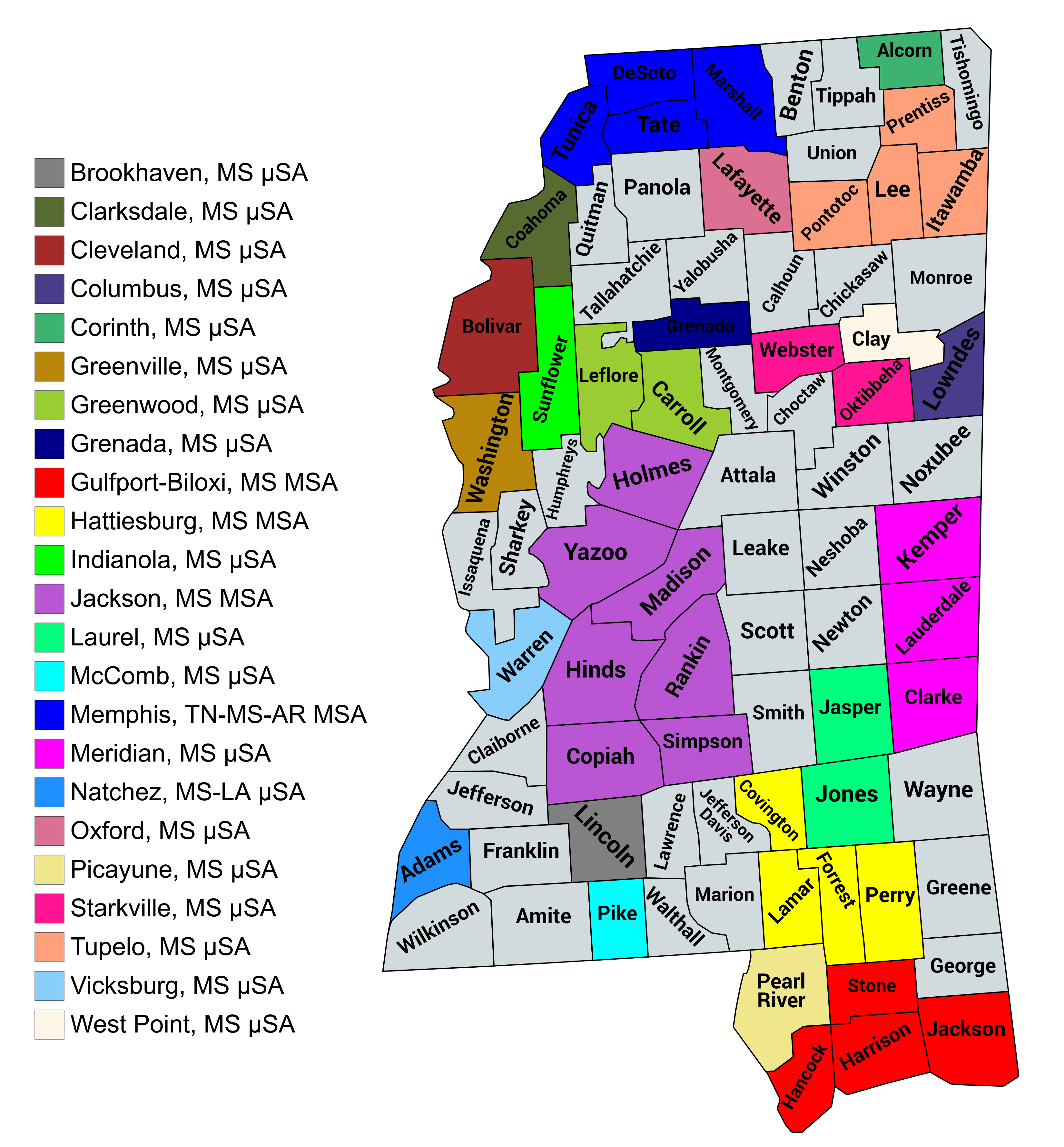
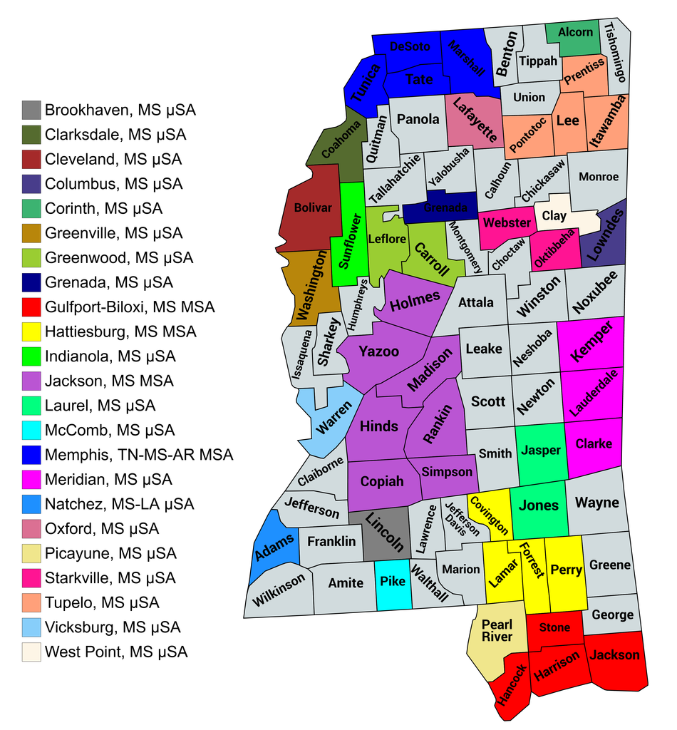
Map of the core-based statistical areas in the state of Mississippi
Summary edit
| Description |
English: Map of the core-based statistical areas in the state of Mississippi, as of March 2020 |
| Date | |
| Source | mapchart.net |
| Author | Rhone Talsma, via mapchart.net |
Licensing edit
This file is licensed under the Creative Commons Attribution-Share Alike 4.0 International license.
- You are free:
- to share – to copy, distribute and transmit the work
- to remix – to adapt the work
- Under the following conditions:
- attribution – You must give appropriate credit, provide a link to the license, and indicate if changes were made. You may do so in any reasonable manner, but not in any way that suggests the licensor endorses you or your use.
- share alike – If you remix, transform, or build upon the material, you must distribute your contributions under the same or compatible license as the original.
File history
Click on a date/time to view the file as it appeared at that time.
| Date/Time | Thumbnail | Dimensions | User | Comment | |
|---|---|---|---|---|---|
| current | 22:08, 16 February 2021 | | 3,300 × 3,556 (1.04 MB) | Rhonetalsma (talk | contribs) | Uploaded a work by Rhone Talsma, via mapchart.net from mapchart.net with UploadWizard |
You cannot overwrite this file.
File usage on Commons
There are no pages that use this file.
File usage on other wikis
The following other wikis use this file:
- Usage on en.wikipedia.org